Boch Hollow State Nature Preserve
Trail Map
Interactive map showing the trail route for Boch Hollow State Nature Preserve. The map displays topographic information and trail markers.
Elevation Profile
Elevation data not available for this trail.
Chart showing elevation changes along the trail distance. Hover or focus on the chart to see specific elevation values at each point.
Boch Hollow became an official Ohio State Nature Preserve in 2008, designated to protect its rich ecosystems and serve as an environmental education site for Appalachian Ohio ecology. Formerly private land owned by local families, the preserve was transferred to the Ohio Department of Natural Resources (ODNR) with an endowment to support education and conservation programs.
It also hosts the largest known population of the federally endangered Running Buffalo Clover (Trifolium stoloniferum) in Ohio — a rare plant that once depended on bison-disturbed soils.
Size & Setting
The preserve is about 607 acres of forested hills, ridges, ponds, and riparian corridors near the edge of the Hocking Hills region. It lies north of the more famous Hocking Hills State Park but offers a quieter, less crowded forest experience.
Boch Hollow History
The preserve’s name comes from the Boch family, who had once owned property.
In the 1960s, Dr. Francis Kessler (an anatomy and physiology professor at The Ohio State University) and his wife Joyce began acquiring land in what is now Boch Hollow. Dr. Kessler grew up in the area and was deeply interested in preserving its natural character.
The Kesslers envisioned protecting the woodlands, streams, and ecological diversity of the hollow, and using it as a site for nature study and conservation — a purpose that shaped its long-term mission.
Eventually the Kesslers donated the land to the Ohio Department of Natural Resources (ODNR) — formally transforming private property into a public State Nature Preserve. They also helped establish an endowment fund to support preservation and educational programming, ensuring not just protection of the land but active learning opportunities for school groups and visitors.
While the broader Hocking Hills has a long timeline of Native American presence and early settlement use, Boch Hollow’s recorded historical identity focuses more on 20th-century conservation efforts and modern public stewardship rather than early human habitation.
Geology
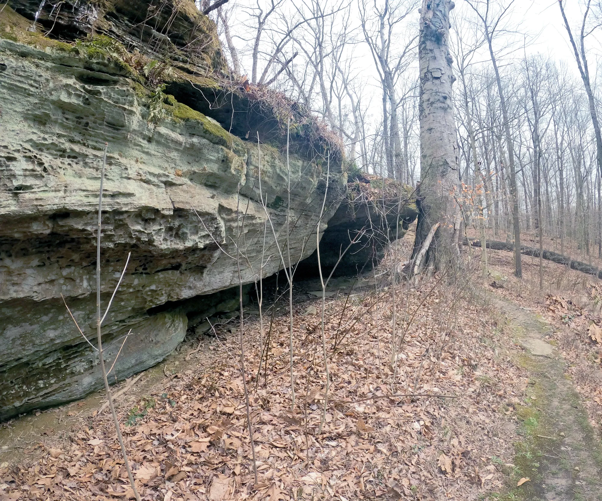
Boch Hollow sits along the southeastern fringes of the Appalachian Plateau, sharing geological characteristics with Hocking Hills — including sandstone outcrops, slopes carved by ancient water action, and forested valleys.
You’ll find riparian corridors, steep wooded hills, ponds, and seeps (wet slopes where groundwater emerges), making the terrain both scenic and ecologically varied.


Water Features
Laurel Falls (also known locally as Robinson or Corkscrew Falls): A rare example of a canyon waterfall in Ohio. Visiting this feature requires a free access permit from ODNR.
Small ponds and streams are scattered throughout the preserve, adding to its ecological diversity and seasonal interest.


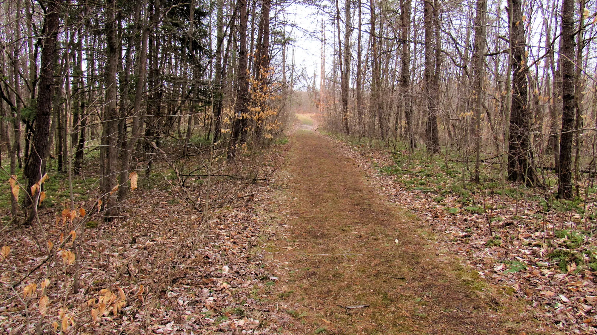
Hiking Trails
There are about 7 miles (11+ km) of interconnected trails weaving through varied terrain like ridges, woods, old fields, pond edges, and sandstone outcrops. A section of the famous Buckeye Trail (Ohio’s 1,444-mile loop trail) runs through the preserve for roughly 4 miles, linking different trailheads.
Key Trails & Routes
Here are some core routes within the preserve (usually accessed from the three primary trailheads on Beach Camp Road, Bremen Road, and State Route 664):
- Boch Hollow Loop (moderate ~6.6 mi): A popular loop trail with diverse scenery — woods, ponds, ridges, and rock outcrops — gaining roughly 1,100 + ft in elevation.
- Buckeye + Meadow + Pond Loop (~3.5 mi): Combines Buckeye Trail with short connectors through meadow and around small ponds.
- Cemetery & Buckeye Loop (~2.7 mi): Offers a quieter forest walk to a pioneer burial ground.
- Historical/Guided Hikes: Occasional guided hikes (like America 250 History Hike) explore early surveyors’ routes and landscape history along a ~3 mile moderate trek.
⚠️ Dogs and pets are not permitted on Ohio State Nature Preserve trails.
Mission
The preserve’s mission emphasizes hands-on environmental education, with programs geared toward school groups, civic organizations, and visitors.
Conclusion
We enjoyed hiking Boch Hollow and seeing Laurel Falls. It is really nice and peaceful compared to Old Man's Cave and the other well-known Hocking County spots. You won't regret a visit to Boch Hollow.