Marietta
Trail Map
Interactive map showing the trail route for Marietta. The map displays topographic information and trail markers.
Elevation Profile
Elevation data not available for this trail.
Chart showing elevation changes along the trail distance. Hover or focus on the chart to see specific elevation values at each point.
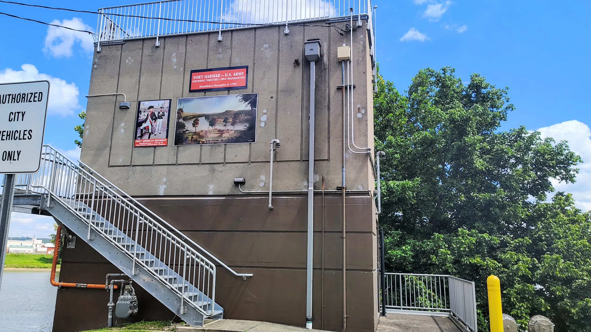
Marietta, Ohio, has a rich history connected to river exploration, early American expansion, and outdoor recreation. Founded in 1788, Marietta was the first permanent settlement in the Northwest Territory, making it the oldest city in Ohio. It was established by the Ohio Company of Associates, a group of Revolutionary War veterans led by Rufus Putnam.
The city’s name honors Marie Antoinette of France, recognizing France’s assistance during the Revolutionary War.
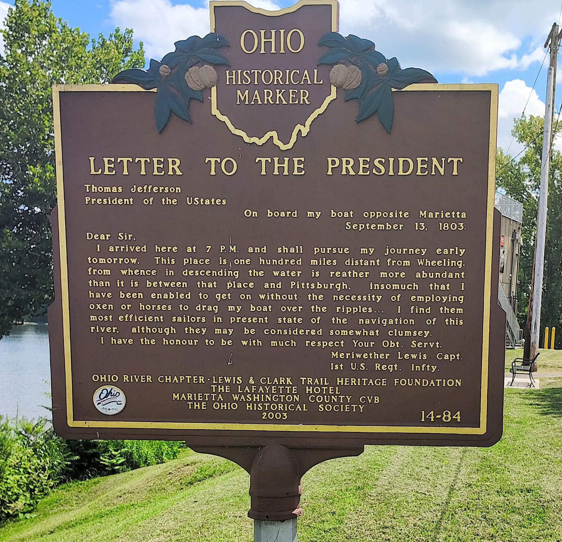
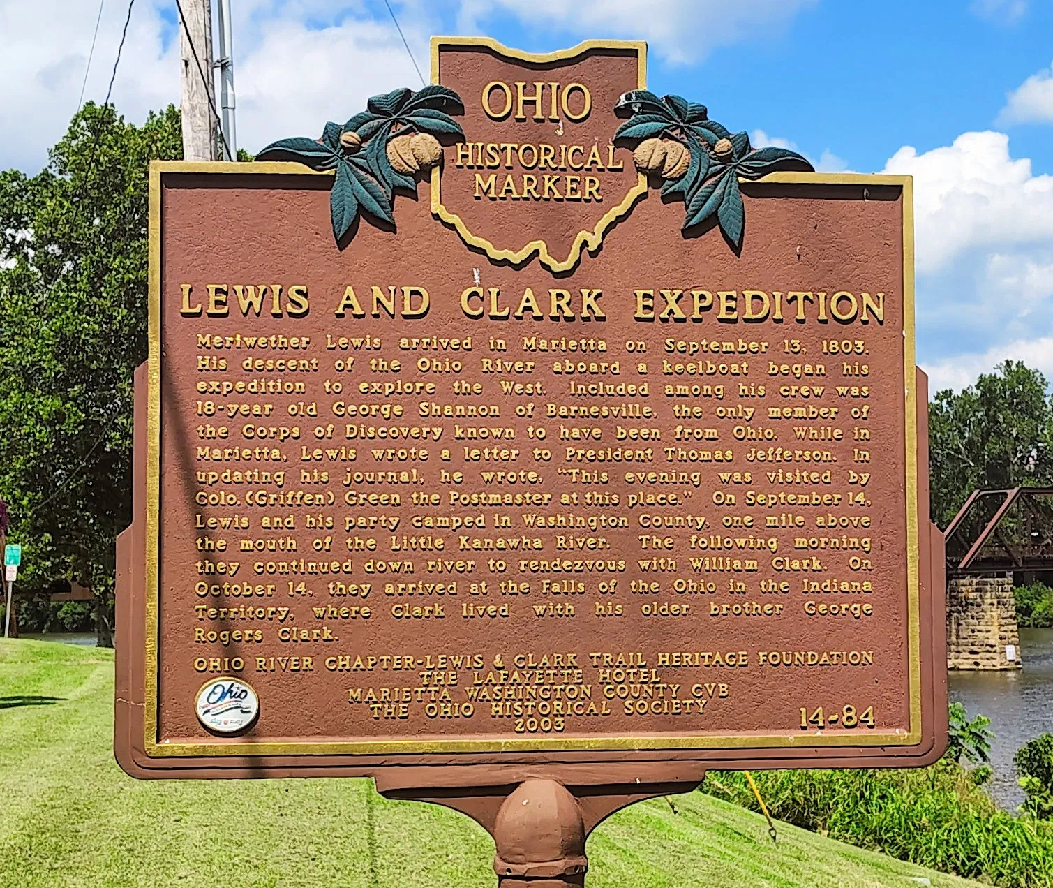
Marietta became a key hub for western expansion and early frontier life, with ties to the spirit of exploration that also characterized the Lewis and Clark Expedition (though the expedition itself launched from St. Louis, Marietta was a major stopover for settlers moving westward around the same time period).
Ohio River & Ohio River Islands National Wildlife Refuge
The Ohio River defines Marietta’s southern border, where it meets the Muskingum River. Buckley Island, located in the Ohio River just south of Marietta, is part of the Ohio River Islands National Wildlife Refuge. Buckley Island lies in the Ohio River between Marietta, Ohio (on the Ohio side) and Williamstown, West Virginia (on the West Virginia side).
The main access point for the nearby refuge chap is the visitor center of the Ohio River Islands National Wildlife Refuge, located at 3982 Waverly Road, Williamstown, WV.
There’s a public boat ramp under/near SR 14 bridge in Williamstown, WV, which is noted as one of the access ramps for Buckley Island. Boat or kayak/canoe access is needed. The island is not accessible by car.
Wear sturdy footwear, expect underbrush and steep banks/rocky shore when landing. The refuge warns of “steep banks and rock dikes” on islands.
Visit in daylight only: the refuge states its lands (including islands) are open from one hour before sunrise to one hour after sunset. Bring water, sun protection, and insect repellent. Since the island has no facilities (no restrooms on the island) you’ll need to be self-sufficient. Observe refuge rules: No camping, no open fires, no cutting firewood, no permanent structures, no collecting artifacts.

For easier trails/less challenge: stay on the mainland tract (near visitor center) where there are maintained trails like the Upland Trail (≈1.2 miles) and Riverview Trail.
Buckley Island History

There was an amusement park on Buckley Island (on the Ohio River between Marietta, Ohio and Williamstown, West Virginia). Historically known by several names (DeVoll’s, Kerr, Marietta and Meigs Island) before becoming known as Buckley Island. In 1897, the Buckeye and Eureka Pipeline Company (BEPC), also known as Buckeye-Eureka Park. purchased the island and developed an amusement park on the southern end. The park featured a dance pavilion (about 80×60 ft), bowling alleys, horseshoe pits, swings, picnic grounds, and even a merry-go-round. Despite having the name “amusement park,” this island didn’t have the thrill rides that modern-era parks like Cedar Point or Kings Island do. Rather, the Buckeye-Eureka Park had more of a local charm featuring simpler forms of entertainment like bowling alleys, horseshoe pits and a dancing pavilion, which was two stories tall and “built in a Victorian style.”
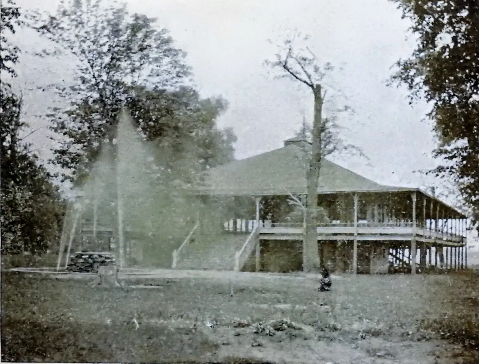
Opening on July 15, 1897, the park initially just served local employees of the company and their families, but as word spread, workers from oil fields deeper into Ohio and West Virginia came to see the park. Contrary to modern theme parks that operate seasonally or year-round, Buckeye-Eureka Park was not an everyday attraction and only operated on set days that the BEPC elected to hold a “picnic,” according to local historian Ben Blaine.
A flood in 1907 washed away much of the park: “The pavilion, where thousands had danced for years, was tilted, battered and broken. The park was never rebuilt after that disaster.”
The land became farmland under the Buckley family. In 1998, it was sold to the U.S. Fish and Wildlife Service and included in the Ohio River Islands National Wildlife Refuge.
Marietta as the Gateway to the West
Founded in 1788, Marietta was the first permanent American settlement in the Northwest Territory, established by the Ohio Company of Associates — Revolutionary War veterans granted western lands for their service. The city quickly became a launch point for westward migration into the Ohio Valley and beyond. Many soldiers, explorers, and surveyors passed through Marietta en route to new territories. By the time of the Lewis and Clark Expedition (1803–1806), Marietta was already a well-established frontier hub known for boat building, navigation skills, and exploration — exactly the kinds of expertise that supported westward ventures like theirs.
Marietta’s Shipbuilding Connection
Marietta was a major shipbuilding center in the early 1800s. The city produced flatboats, keelboats, and barges used to travel the Ohio and Mississippi rivers. The U.S. Army Corps of Engineers and frontier militias relied on these vessels for moving men and supplies — including the same types used by Lewis and Clark.
The confluence of the Muskingum and Ohio rivers made Marietta a natural spot for trade, travel, and shipbuilding in the 1800s.

Lewis & Clark Heritage Walking Tour — Marietta, Ohio
Approx. 2.5 miles (4 km) — easy walking loop
Plan for 1.5–2 hours, including museum visits and river views.
Stop 1: Campus Martius Museum Start
601 Second Street, Marietta, OH
Open year-round; admission required.
Free parking is available at the rear of the museum and on-street. Campus Martius Museum’s three floors of exhibits are wheelchair accessible, excluding the second floor of the Rufus Putnam House.
Campus Martius Museum Hours
| Monday-Saturday | 9:30 to 5 |
| Sunday | Noon to 5 |
| Closed | New Year’s Day, Easter, Thanksgiving, Christmas Eve, Christmas Day |
Rufus Putnam House Tour Times: 10AM, 11AM, Noon, 1PM, 2PM, 3PM, 4PM
Admission
Museum admission | ||
| Friends of the Museums or Ohio History Connection Member | Free | |
| Adult | $10.00 | |
| Students K to College (with ID) | $5.00 | |
| Children 5 and under (excludes groups) | Free | |
| Active Duty Military & Veterans (with ID) | $5.00 |
Campus Martius Museum was built on the site of the original stockade, built by the Ohio Company between 1788 and 1791. The name, Campus Martius, chosen by the Ohio Company, comes from Latin for Field of Mars, the military camp where the legions of ancient Rome once trained. Known by the early settlers as the stockade or Campus Martius, the original fortification was built to house and protect the members of the Ohio Company during the Ohio Indian Wars of 1790 to 1794. By 1795, after the signing of the Treaty of Greeneville, the stockade was no longer necessary. Buildings were then dismantled, the wood planks used in the construction of some of the homes located throughout Marietta.
Marietta's founder was Rufus Putnam, a Revolutionary War general who surveyed much of the Northwest Territory. His surveying and mapping efforts laid groundwork for future exploration beyond the Mississippi — paving the way for Lewis and Clark’s mission of charting the Louisiana Purchase.
Of horizontal plank construction, the Rufus Putnam House, part of the original stockade, is enclosed inside the museum. Rufus Putnam and his wife, Persis, remained in this house on its current site until their deaths. The house was restored by the Ohio Historical Society (currently the Ohio History Connection) between 1966 and 1972. The museum is also the present site of the Ohio Company Land Office, which was moved there in 1953 to insure its future preservation. In this office, land deeds were allotted for the original Ohio Company Purchase. Here, Rufus Putnam, the first surveyor- general of the United States, made some of the earliest maps of the Northwest Territory.
Stop 2: Mound Cemetery .4 miles
Fifth and Scammel Streets
It is home to one of the largest conical Adena mounds in the Ohio Valley — a visible link to the ancient Indigenous cultures that Lewis and Clark later described in the West. Lewis and Clark’s journals later recorded similar features and cultures farther west — showing continuity in early American encounters with Indigenous peoples. The Mound Cemetery and Ancient Earthworks Park in Marietta preserve these connections. The cemetery contains graves of Revolutionary War veterans and early settlers who helped open the Northwest Territory.
Stop 3: Ancient Earthworks Park (Capitolium Mound Site) .3 miles
Between Third and Sacra Via Streets
The site preserves one of Marietta’s ancient Hopewell ceremonial mounds. Early settlers — including the founders of Marietta — carefully mapped and preserved it, an early example of archaeological respect. When Lewis and Clark later documented mounds and artifacts along the Missouri River, they built on this same emerging interest in America’s prehistoric cultures.
Stop 4: Ohio River Museum .7 miles
601 Front Street (next to the river)
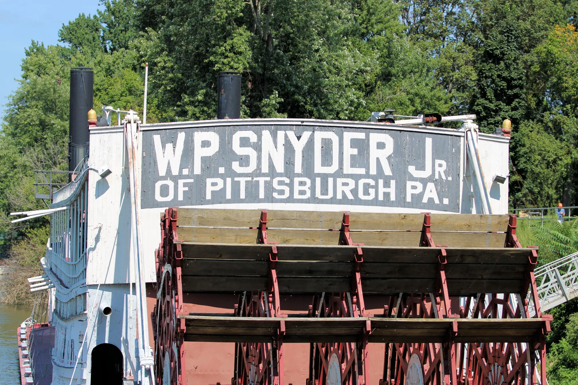
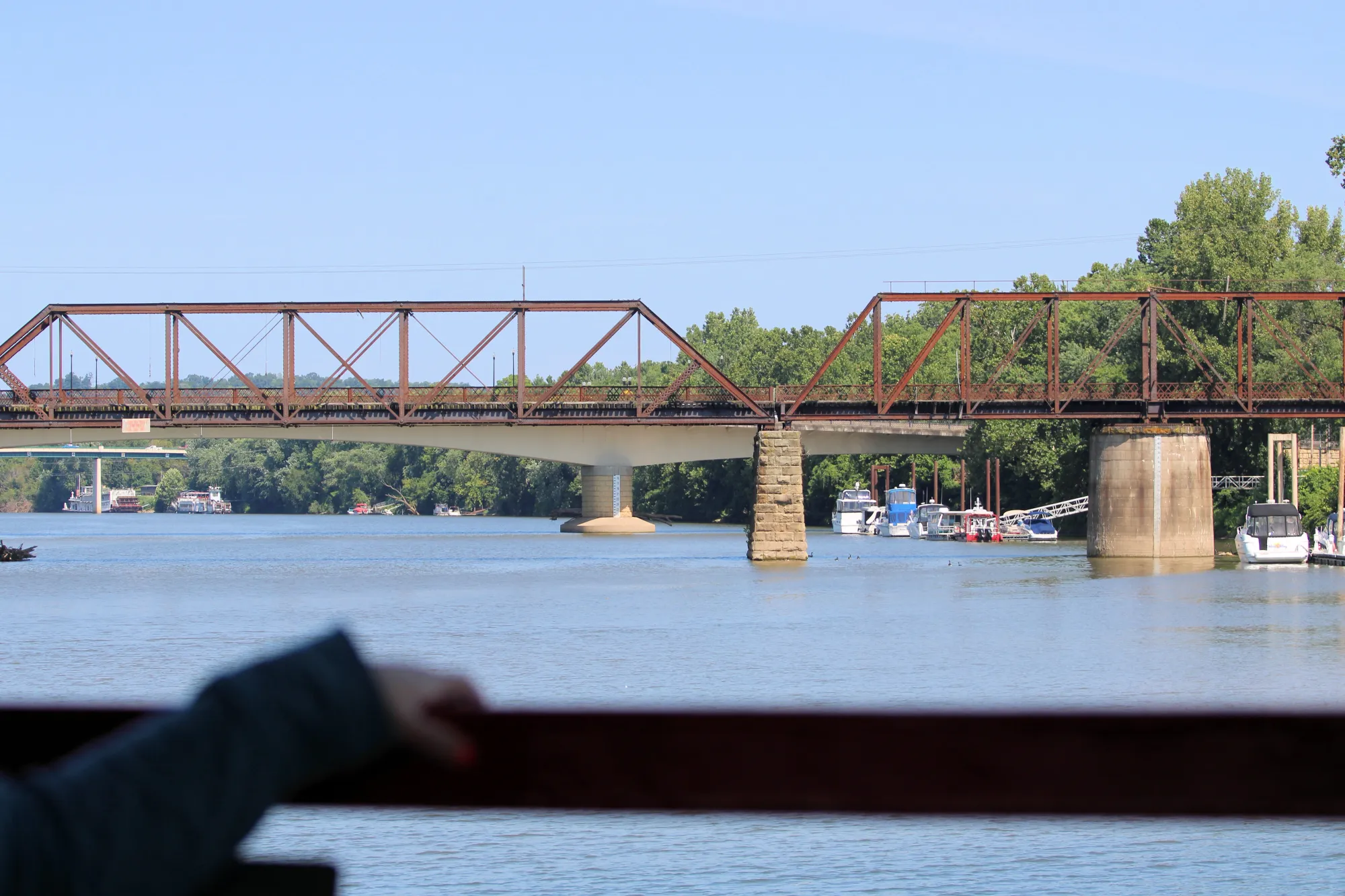
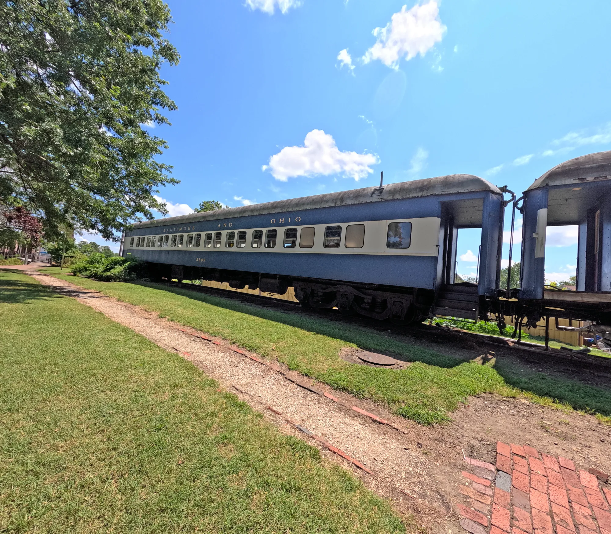
Focuses on the Ohio and Muskingum Rivers, the main highways of early western exploration. You’ll see models and full-sized flatboats and keelboats — the same that Lewis and Clark used on their expedition. The museum includes the W.P. Snyder Jr., the last intact steam-powered sternwheel towboat in the U.S. There are maps showing how Marietta connected by river to Pittsburgh, the Lewis & Clark departure city. Also on display are navigation tools and river charts similar to those carried by Lewis and Clark.
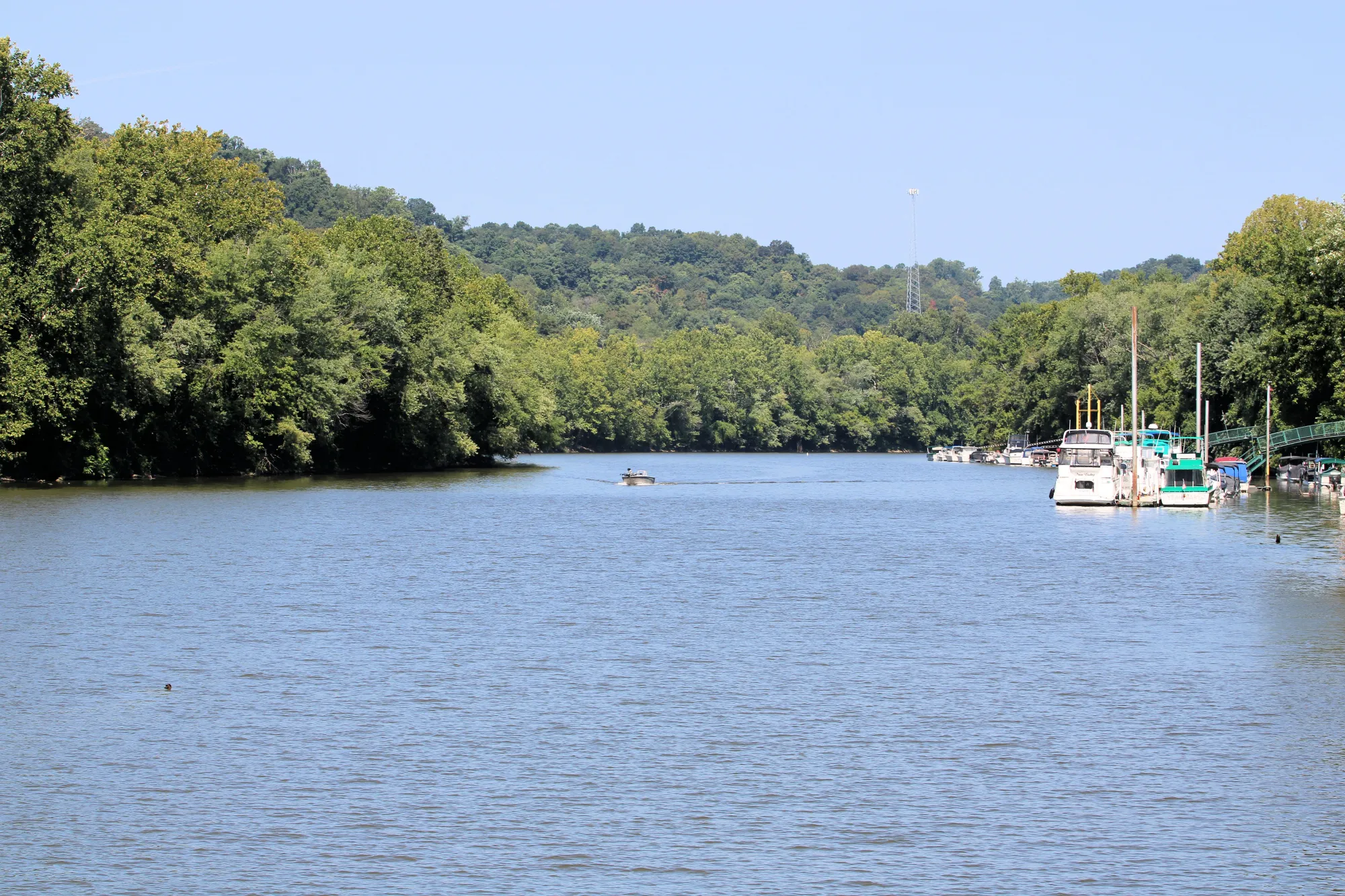
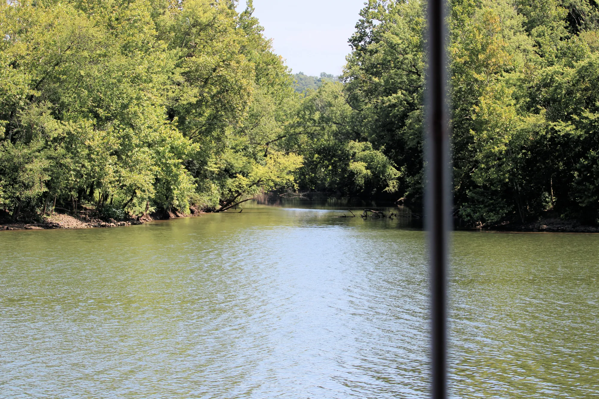
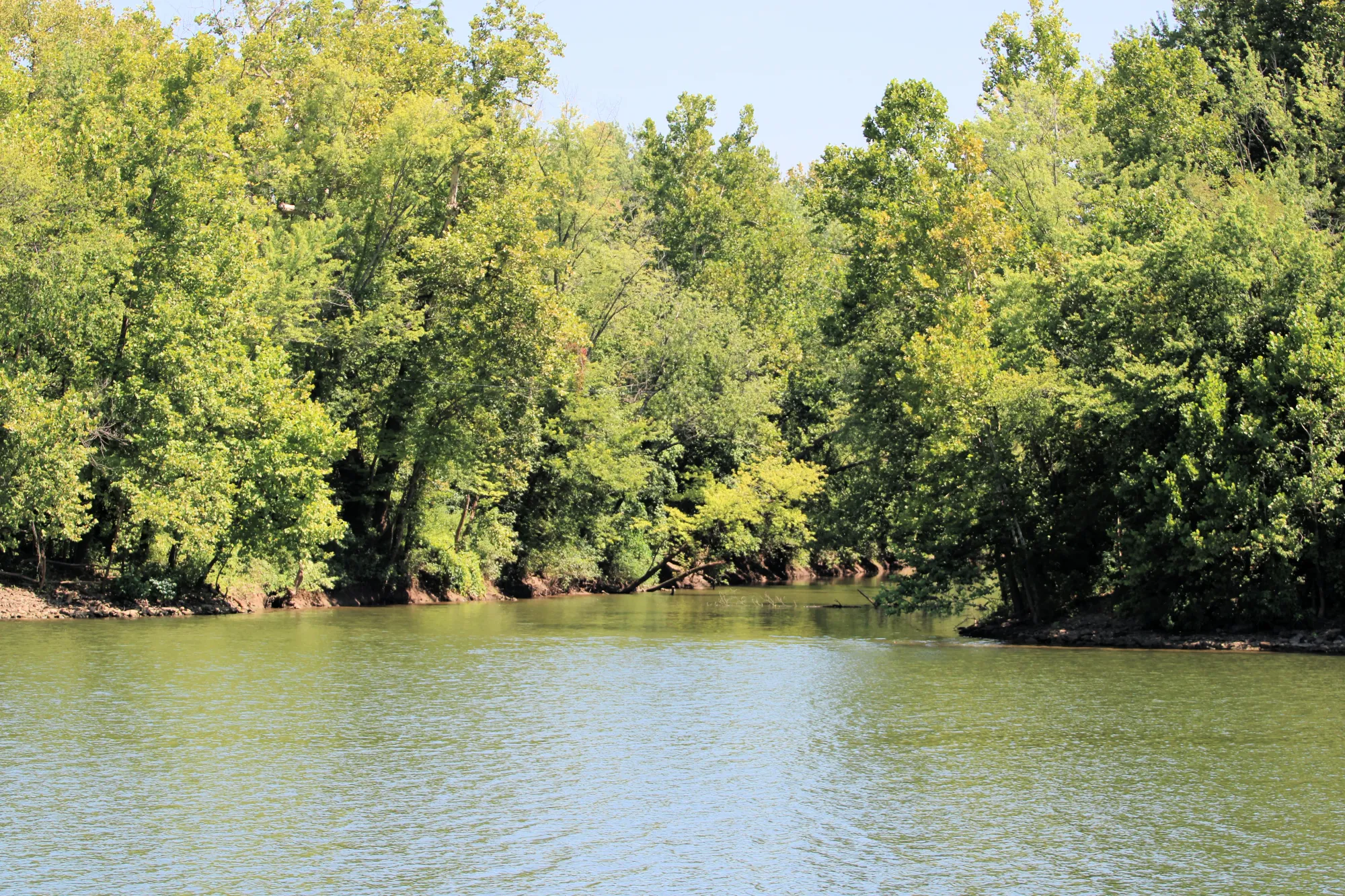
Stop 5: Marietta River Trail (Start behind the museum) .1 miles
Trailhead: Ohio River Museum area
This scenic path follows the Muskingum and Ohio Rivers, where early settlers launched boats westward. Imagine early river explorers outfitting their journeys here before heading to the Mississippi — just like Lewis and Clark did a few hundred miles downstream.
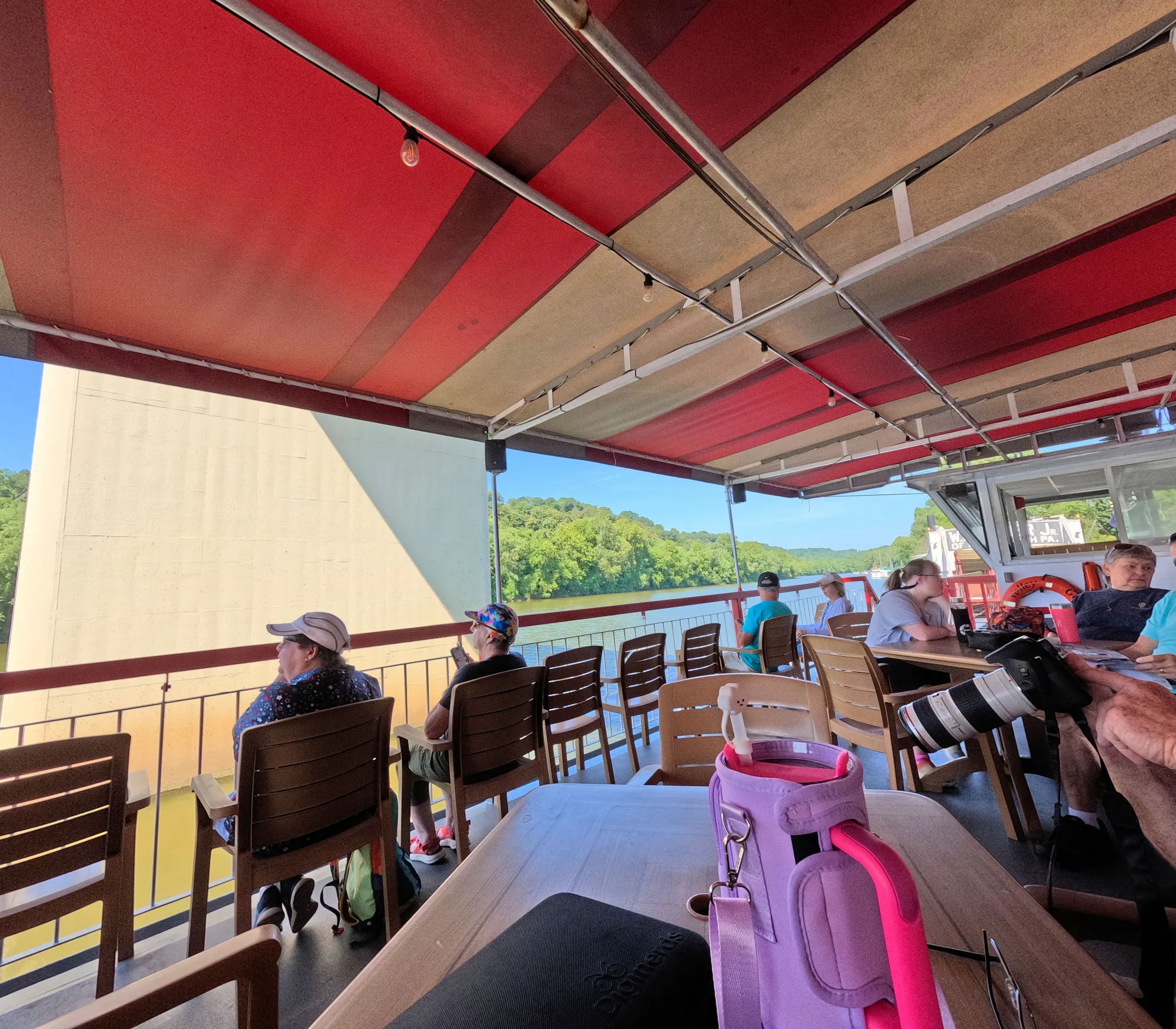
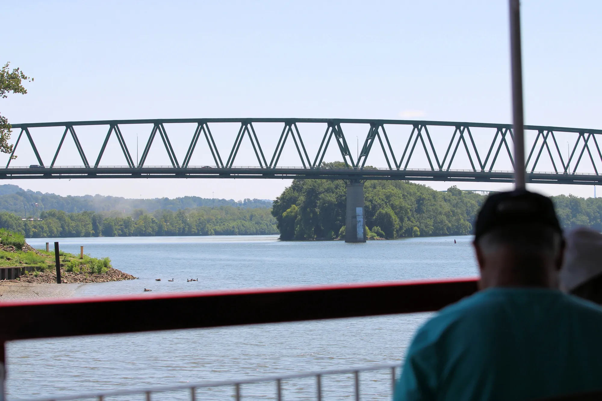
The riverfront is still active today, with historic bridges and the Valley Gem Sternwheeler, offering river cruises that echo those early voyages.
Optional add-on:
Take a short Valley Gem riverboat ride for the full historical atmosphere — trips last about 1–2 hours and depart near the museum.


The Ohio River Sternwheel Festival (held each September), showcasing classic paddlewheel boats, music, and fireworks.
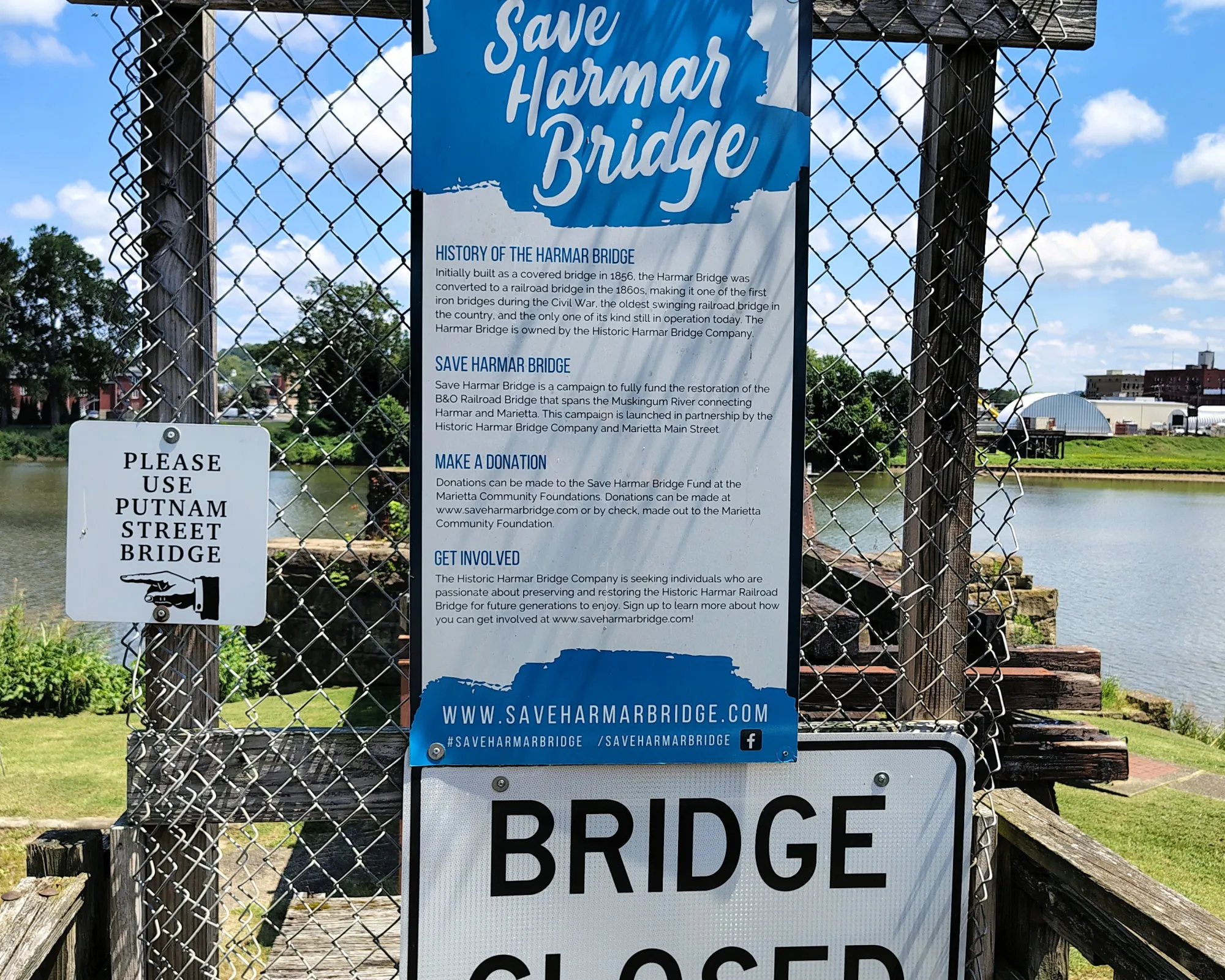
Optional Stop 6: Harmar Village & Train Bridge Walk .5 miles
Cross the Harmar Railroad Bridge (pedestrian walkway) to the west side of the river. Use the Putnam Street Bridge.
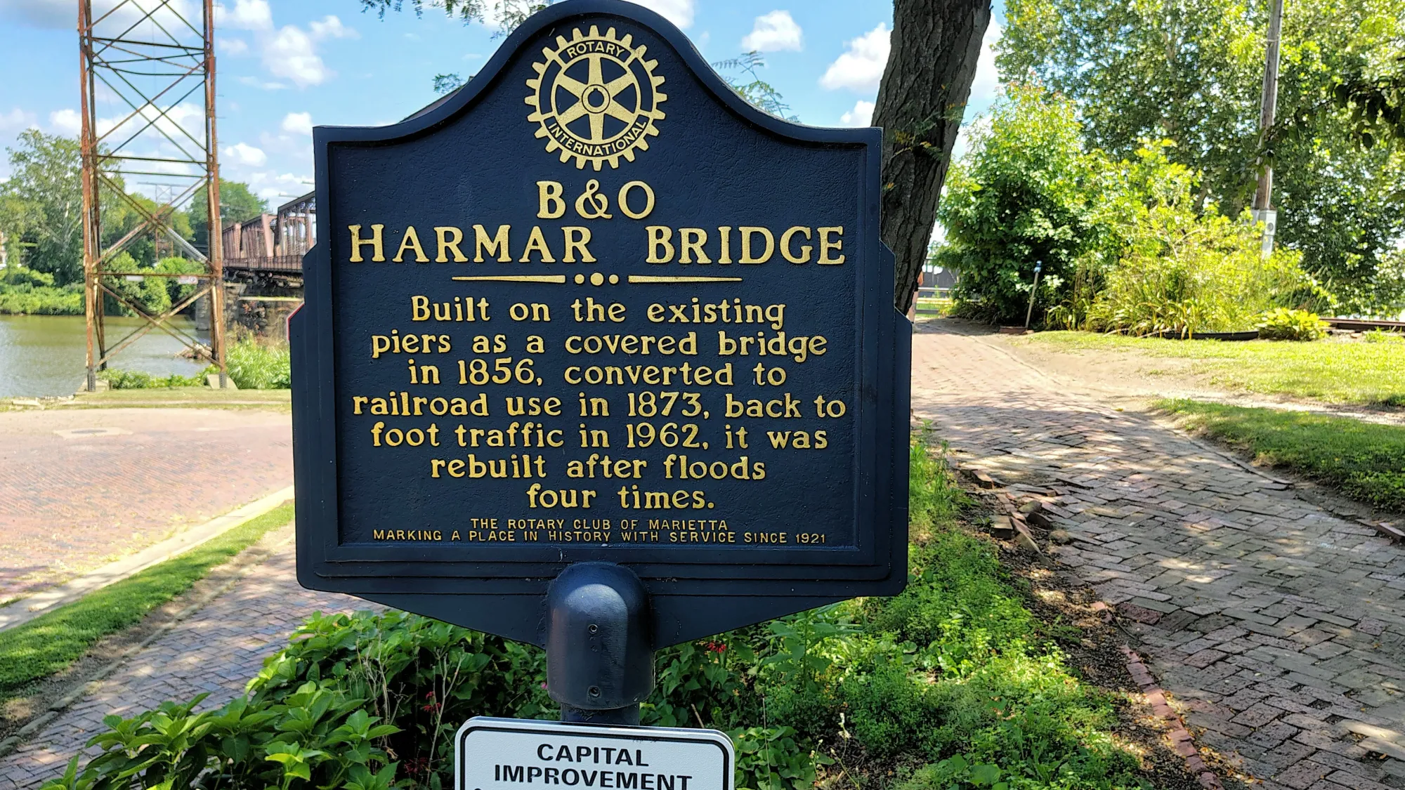

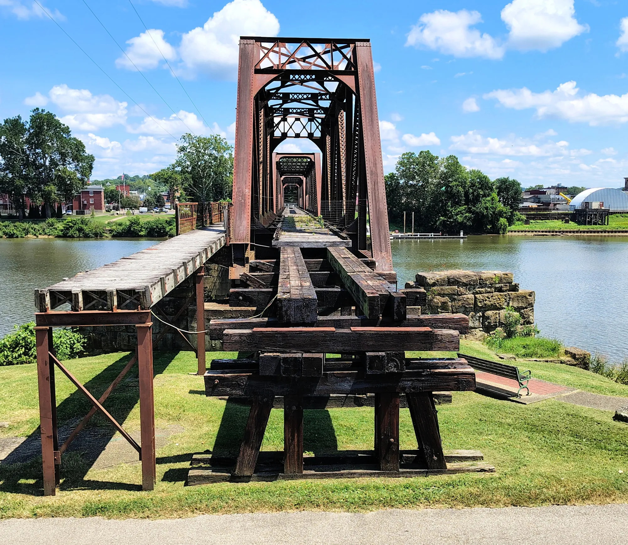
This area was part of early Marietta’s industrial and riverfront history — the kind of frontier craftsmanship (shipbuilding, carpentry, ironwork) that supplied western expeditions. Offers one of the best panoramic views of the Ohio and Muskingum Rivers’ confluence — the gateway to the American West.
Other Hiking and Walking
Marietta, Washington County and Williamstown, WV, offer several scenic trails:
River Trail – 3.5 mile a paved walking and biking path along the Muskingum River from downtown to Indian Acres Park.
Marietta Trail Network – 18.5 mile long system includes paths through Kroger Wetlands, Lookout Point, and Mound Cemetery, where many Revolutionary War veterans are buried. The Network is open to bicycle and foot traffic only and use during wet or muddy conditions is discouraged
Wayne National Forest (just outside Marietta) – provides miles of hiking, biking, and horseback trails through Appalachian foothills and river valleys.

Trailhead Location for Williamstown, West Virginia
3982 Waverly Road, Williamstown, WV (ORINWR Visitor Center)
Directions from Marietta:
- Cross the Williamstown Bridge into West Virginia
- Take the first left after a local landmark (DaVinci’s Restaurant) onto Waverly Road (E. 4th St.)
- Continue ~2 miles to the Visitor Center parking lot.
- Restrooms and potable water only available at the Visitor Center (the “Buckley Mainland” tract)
- From the Visitor Center parking lot the Birds & Butterflies Trail branches off; the Upland Trail and Riverview Trail both start from near this parking area.
Upland Trail
- Length: ~1.2 miles.
- Trail surface: Starts gravel, then turns into single‑track footpath; hilly, passes through ~3 ravines and climbs to a ridge before looping back.
- Difficulty: Moderate due to elevation change and terrain.
- Recommended starting point: Visitor Center parking lot; follow the short Birds & Butterflies Trail to the junction, then take Upland Trail branch.
Riverview Trail
- Length: ~0.7 miles.
- Trail surface & terrain: After branching from the Birds & Butterflies path (near Visitor Center), the trail descends to the floodplain, begins on gravel then shifts to mowed grass in riparian forest near the river.
- Difficulty: Easy — mostly flat, suitable for a relaxed walk.
- Starting point: Same Visitor Center parking lot; take the Birds & Butterflies path, then branch onto Riverview Trail.
Underground Railroad
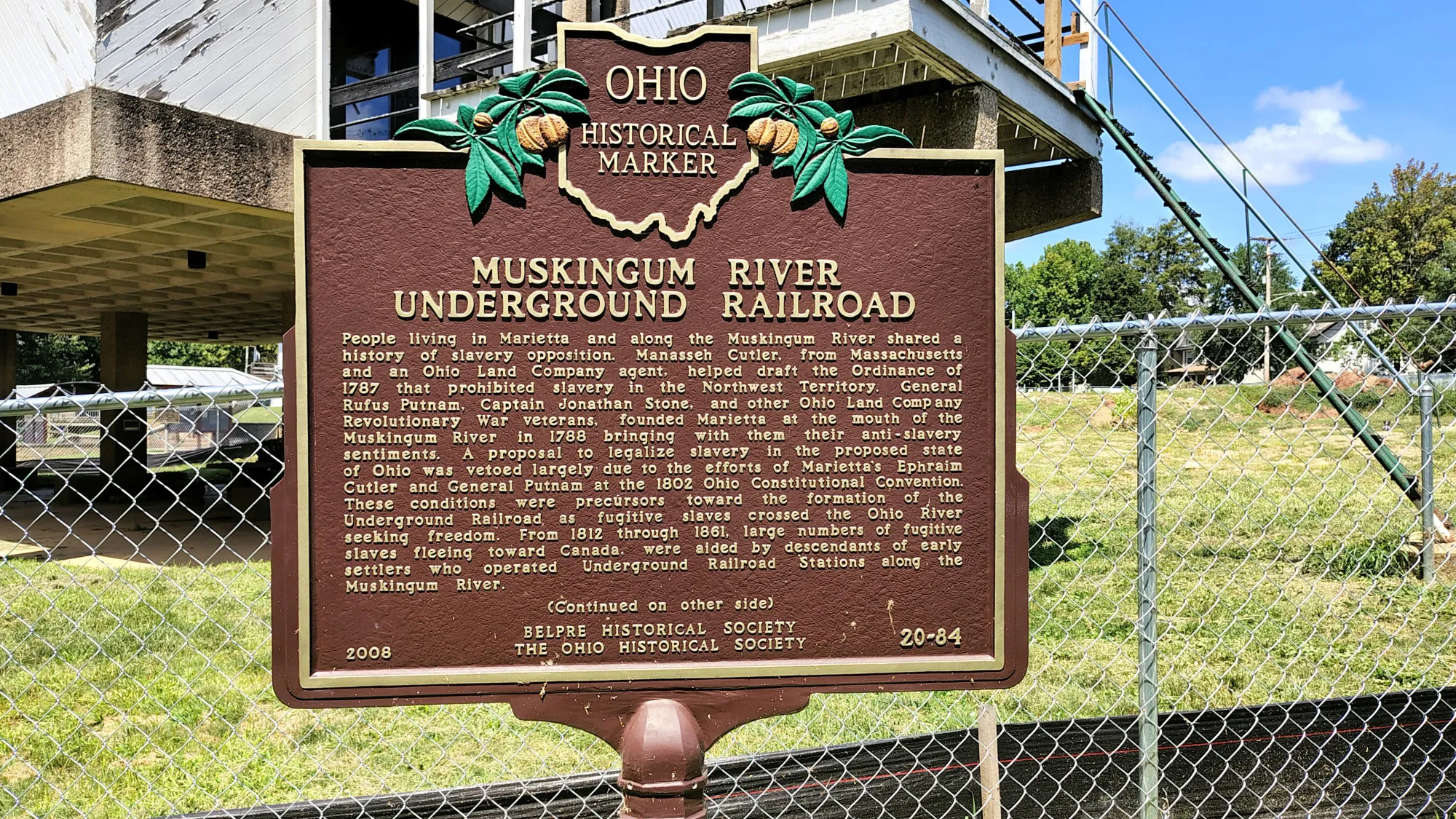
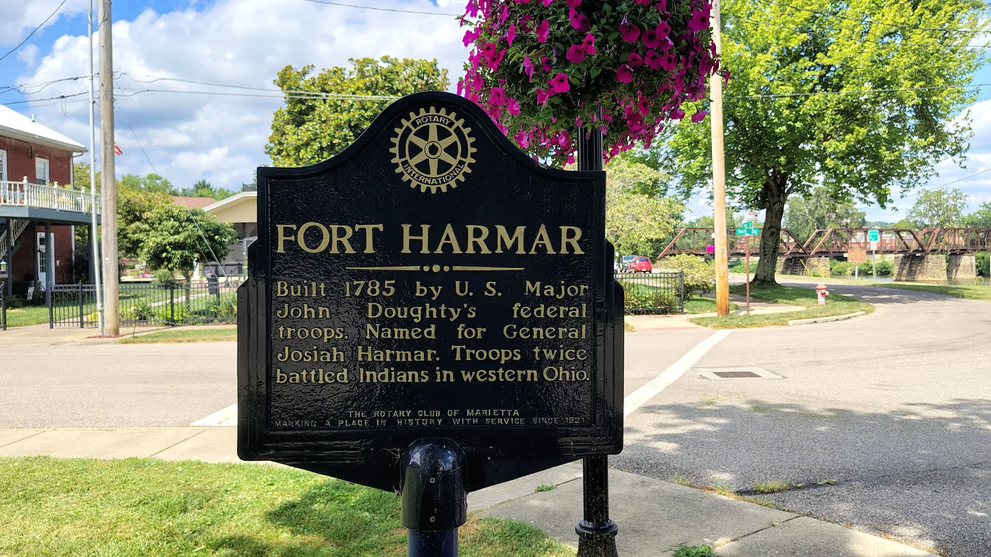
We found this historical marker while we were in Marietta.
Conclusion:
There is a great amount of historical information connected to Marietta, Ohio. I have visited Marietta for work and pleasure. We used to race standardbred horses at the Washington County Fair every summer. So, I was familiar with the fairgrounds. As an auditor I visited the downtown area often.
It was a sincere pleasure to take the Valley Gem Riverboat ride and to explore Marietta. There is plenty of walking and hiking to be found and it is a beautiful place to visit. I highly suggest you put Marietta on your list.

More in