Cantwell Cliffs
If you want to escape the crowds and experience one of the most picturesque spots in Hocking Hills, Cantwell Cliffs is your destination. Located 17 miles from Old Man's Cave in the northern reaches of the park, its remote location discourages casual visitors — but those who make the extra drive are rarely disappointed. Many longtime hikers consider this the most beautiful and underrated area in all of Hocking County.
Named for an Early Settler
The cliffs take their name from Josiah Cantwell, one of the first settlers in the Hocking Hills region who arrived in the early 1800s. But people have lived here for much longer — the Adena settled in the area around 7,000 years ago, followed by the Hopewell culture and later the Shawnee and other tribes. These early inhabitants knew the cliffs well, often using the rock shelters for protection from the elements.
When European settlers like Cantwell arrived, they marveled at the same dramatic scenery that draws visitors today. The area remained largely wild and undeveloped, eventually becoming part of the Hocking Hills State Park system in the 20th century.
Location
Cantwell Cliffs OH-374, Rockbridge, OH 43149 | GPS Tracking: (39.539874, -82.575814)
Cantwell Cliffs is one of the 7 major hiking trails of Hocking Hills State Park in southern Ohio.
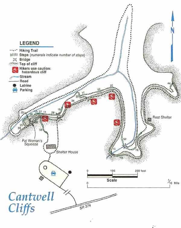
The path is the most rugged in the park system, remote, and a one-way in and one-way out loop.
There are over two miles of trail with two loops, each being one mile.
It takes approximately 60 to 80 minutes to hike each loop of the trail.
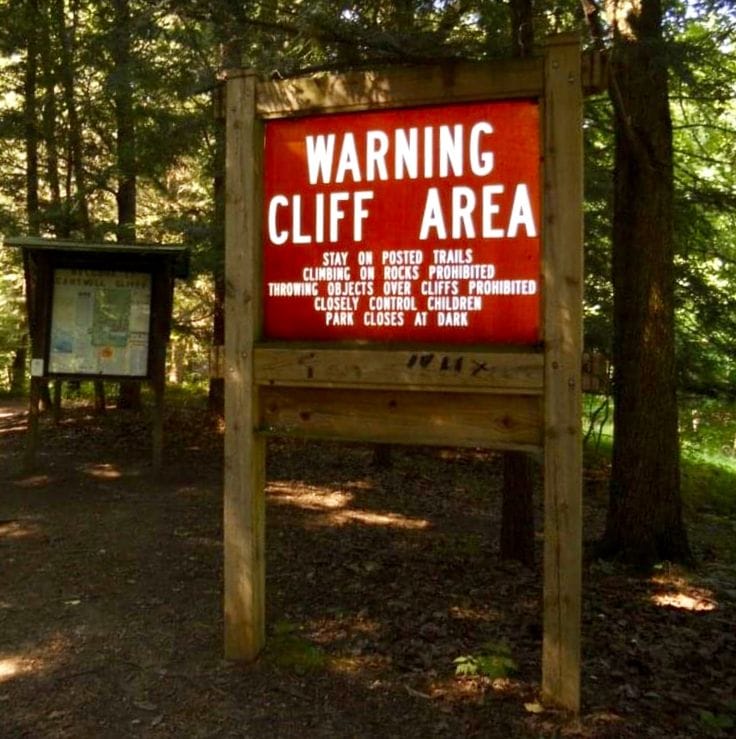
HIKERS MUST REMAIN ON THE MARKED TRAIL. Well-behaved, non-aggressive pets are permitted on leash.
There is NO wading or swimming allowed in the waterfalls or creeks.
The Geology: 350-Million Years in the Making
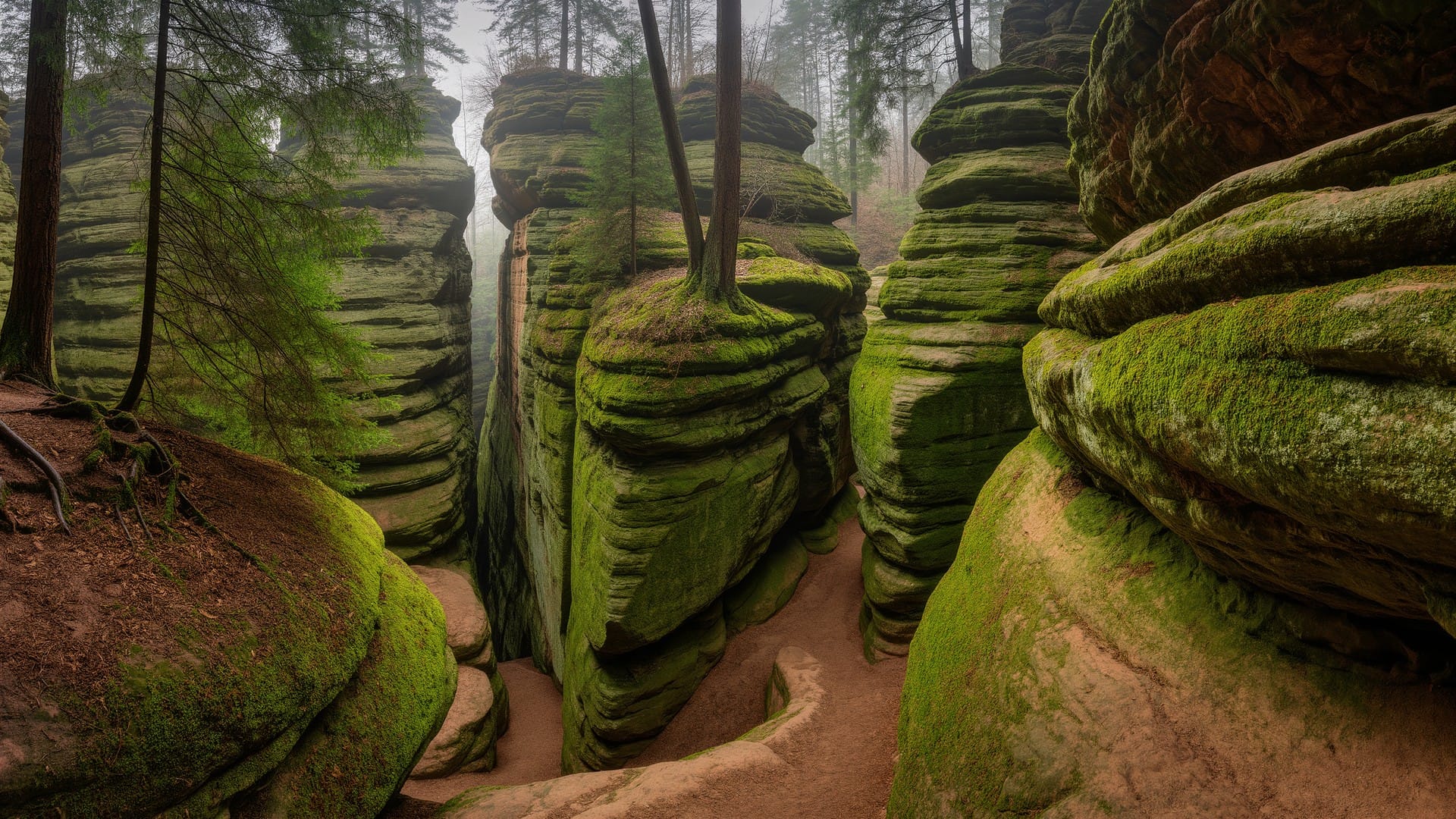
The terrain at Cantwell Cliffs began as bedrock 350 million years ago, when an ocean covered this region. The area where the cliffs now stand was once a shallow sea floor. Changes in currents over millions of years brought sand from distant mountains that deposited in the Hocking Valley, creating the distinctive Blackhand sandstone.
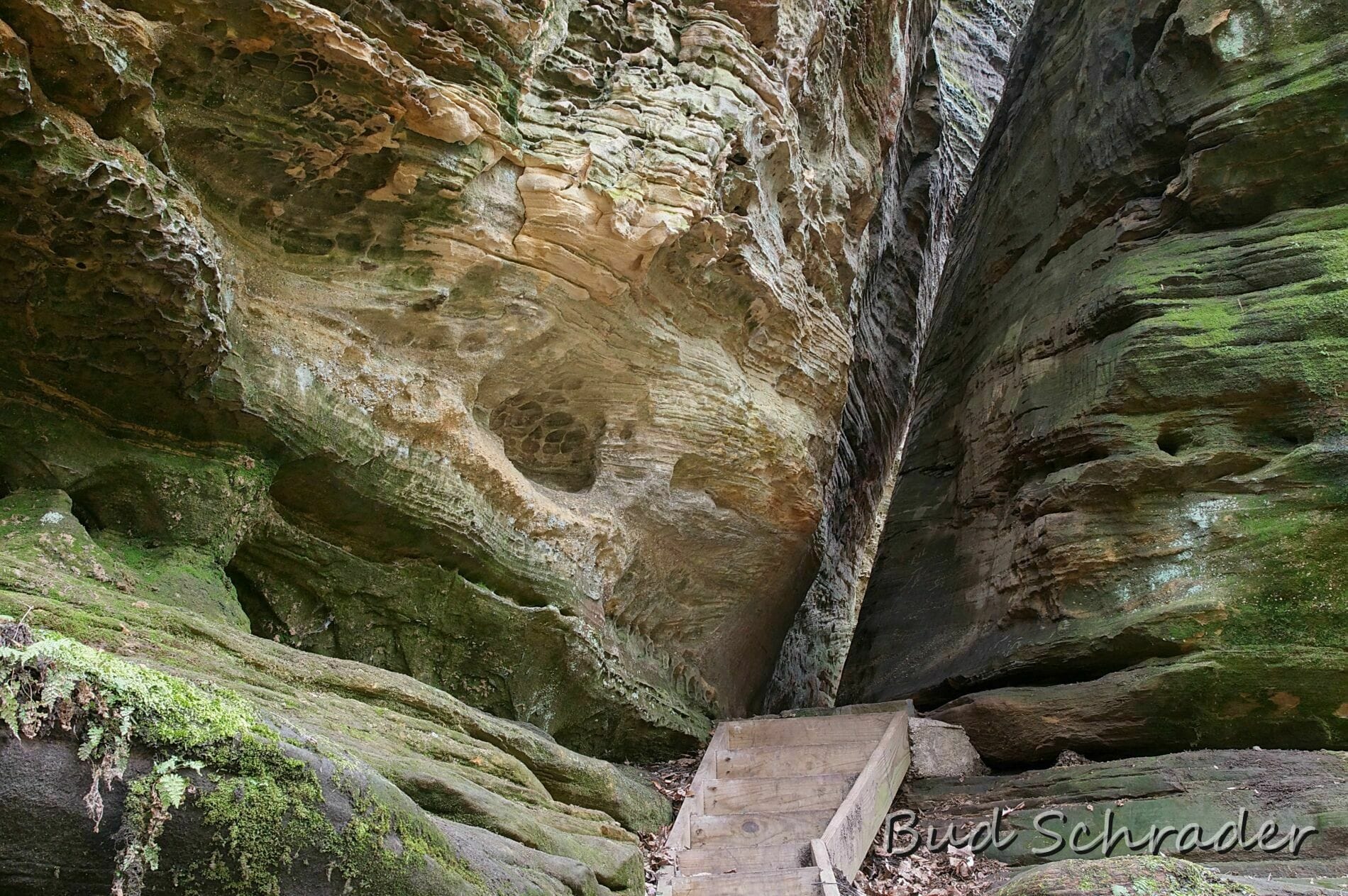
Interestingly, the Cantwell area has unique geological features that set it apart from other Hocking Hills locations. The middle zone of the Blackhand here shows limited cross-bedding, unlike other locations where it's extremely pronounced. You'll also notice an unusual number of concretions — rounded mineral formations — visible on the cliff faces. These formed when minerals precipitated around a nucleus in the original sand, creating harder nodules that resist erosion.
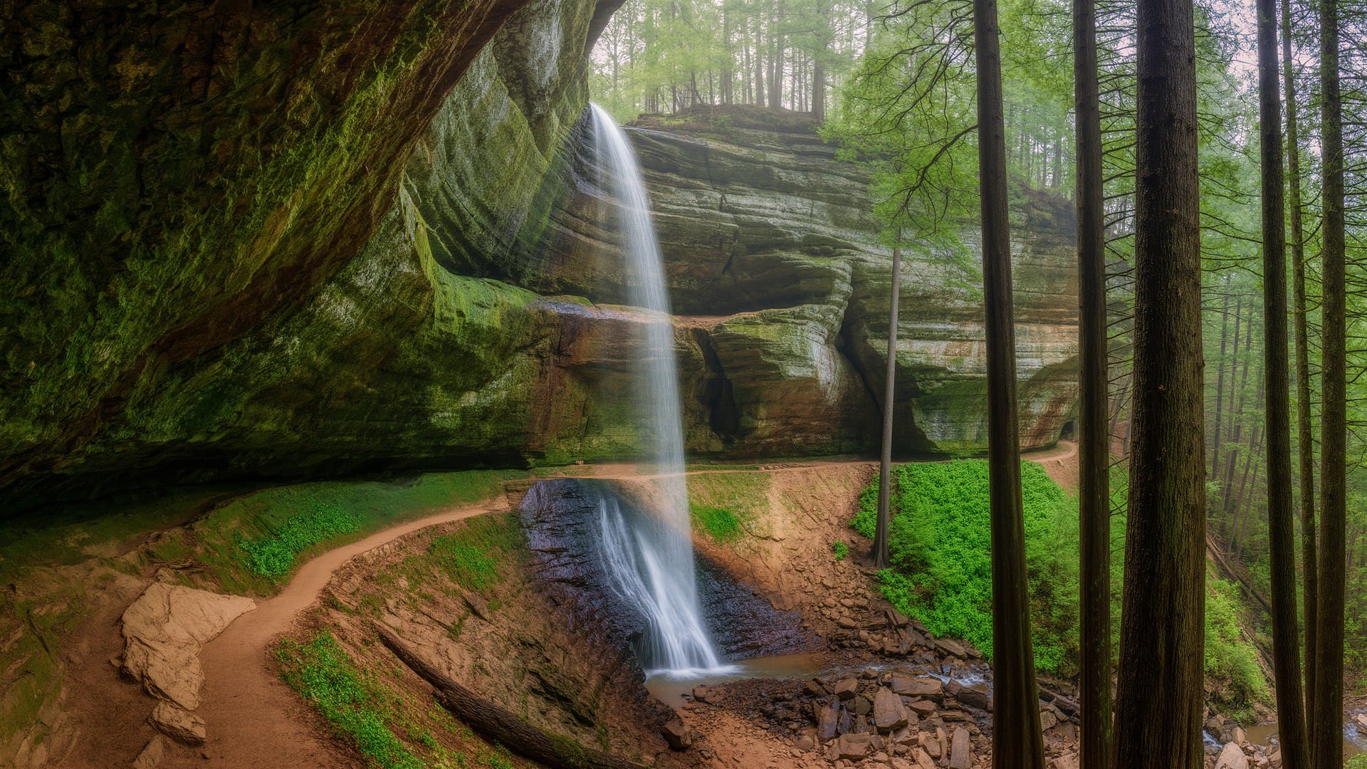
Ages of uplift, retreating glaciers, and erosion have sculpted these spectacular layered ledges and recess caves. The erosion caused by Buck Run — a creek that spills over a portion of the cliffs forming a seasonal waterfall — accounts for the deep valley, steep cliffs, and rock shelter formations you'll explore today.
Location and Visitor Information
Cantwell Cliffs is located off State Route 374 in the northern part of Hocking Hills State Park, about 17 miles from Old Man's Cave.
Address: State Route 374, Rockbridge, OH 43149
GPS Coordinates: 39.5418, -82.5126
Distance from Columbus: Approximately 45 miles (about 1 hour)
Hours: Dawn to dusk, year-round. Best visited March through November when trails are dry.
Facilities: Pit toilet restroom and picnic shelter at the trailhead. No water or electricity available.
Pet Friendly: Yes! Dogs are welcome but must be on a leash. However, the challenging terrain may not be suitable for all dogs.
This is the least crowded of the seven main Hocking Hills areas — even on summer weekends, you'll likely find more solitude here than anywhere else in the park.

Hiking Trail
The Cantwell Cliffs Loop is a moderately challenging hike that delivers big rewards.
- Distance: 0.9 miles (loop)
- Time: 45 minutes to 1 hour (take your time to explore)
- Elevation gain: About 225-270 feet
- Difficulty: Moderate to strenuous
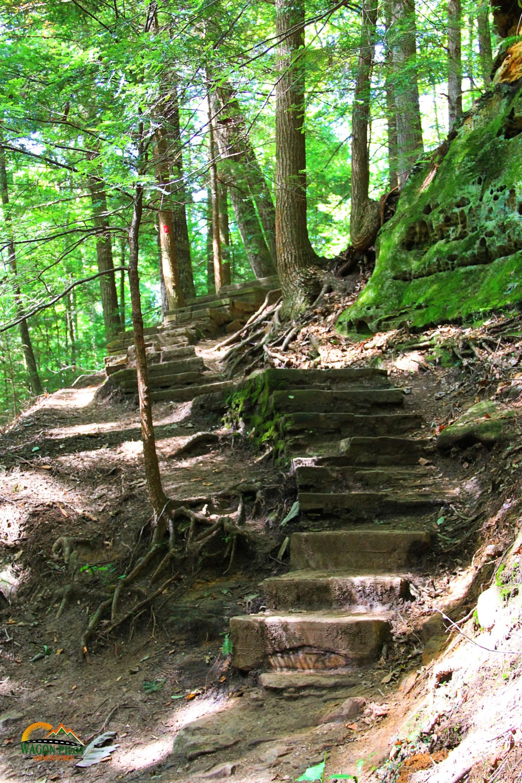
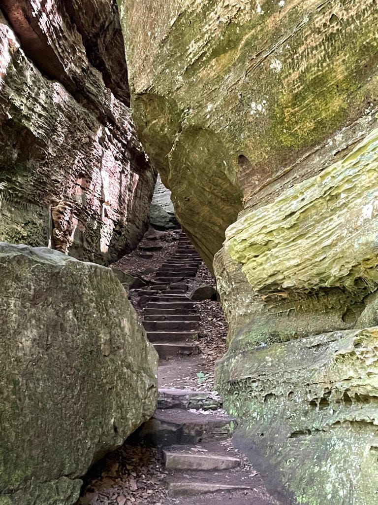
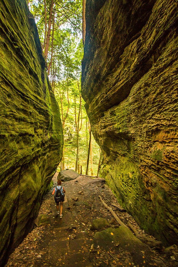
A short 0.1-mile spur trail leads from the parking lot to the rim of the gorge, where you'll get your first breathtaking view. From there, the trail descends into the gorge through narrow passageways formed by massive slump blocks that have fallen away from the main cliff. These car-sized boulders create tunnels and crevices that add an element of adventure to the hike.
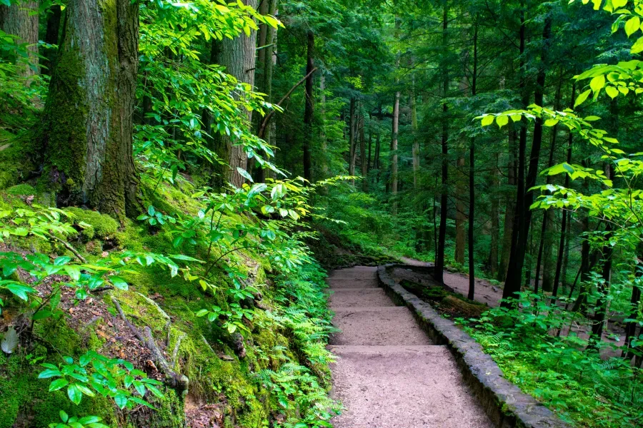
The descent involves navigating stairs carved into the rock and some sections where you'll need to use your hands for balance. At the bottom, the trail follows the base of the cliffs before ascending the other side to complete the loop.
Important Note: This trail is recommended for moderate to experienced hikers due to the elevation changes, narrow passages, and uneven steps. Young children may struggle with some of the climbing sections, and the trail is not accessible for wheelchairs or strollers.
What You'll See
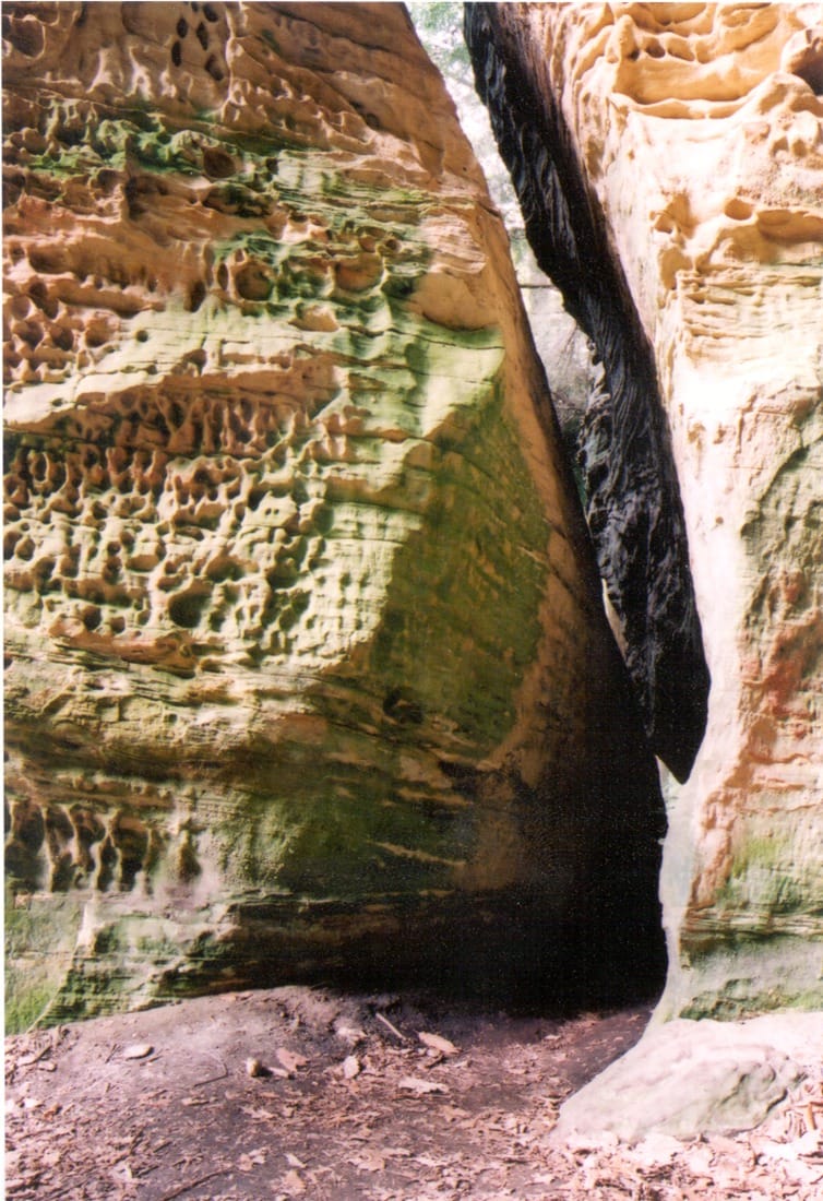
Fat Woman's Squeeze
This is the highlight for many visitors — a tight, narrow passageway that descends between a huge boulder and the cliff from which it slipped thousands of years ago. The passage is only about 18 inches wide at its narrowest point and adds an element of adventure to the hike. You'll need to turn sideways and squeeze through, which is half the fun!
Despite the name (which dates to a less politically correct era), most adults can fit through — though those with broader shoulders or carrying large backpacks may want to leave their gear with a companion. If you're uncomfortable with tight spaces, there's an alternate route around the squeeze.
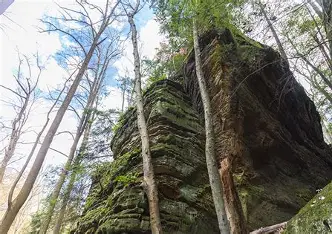
The Towering Cliffs
The cliffs tower over 150 feet high, overlooking Buck Run creek below. Standing at the base and looking up, you gain a true appreciation for the scale of geological time. The massive walls of Blackhand sandstone display layer upon layer of ancient deposits, each representing thousands of years of sedimentation.
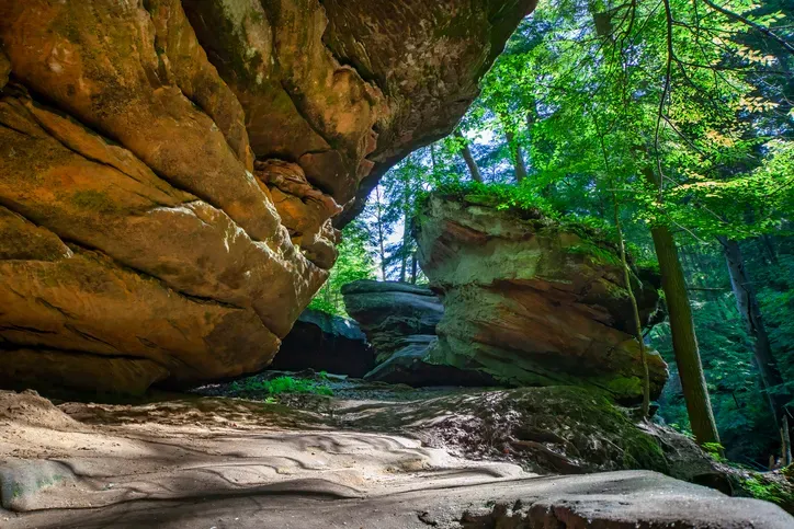
Rock Shelter
At the base of the cliffs, you'll find a rock shelter carved out by erosion over millions of years — a natural overhang that provides shelter and shade. Imagine Native Americans taking refuge here during storms, or early settlers resting in the shade on hot summer days. The shelter demonstrates how the softer middle layer of sandstone erodes faster than the harder upper layer, creating these characteristic Hocking Hills overhangs.
Seasonal Waterfall
Buck Run spills over a portion of the cliffs, forming a waterfall that's most impressive after rainfall or during spring snowmelt. Unlike the more consistent waterfalls at Old Man's Cave, this one is truly seasonal — visit after a good rain for the best experience. When it's flowing well, the water cascades down the rock face in a beautiful curtain.
Conclusion
Cantwell Cliffs is a true hidden gem in Hocking Hills. If you’ve already checked out Old Man’s Cave, Ash Cave, and Cedar Falls, it’s worth making the extra drive north for a change of scenery. The secluded setting means fewer crowds, the Fat Woman’s Squeeze adds a fun challenge, and the towering cliffs create that awe-inspiring vibe that keeps hikers returning to this area.
It’s a great pick for anyone after a moderately challenging hike with amazing rewards. Just be ready for plenty of stairs and some elevation changes — every step is worth it.
Happy hiking!
More in
Hocking Hills State Park: Every Trail Ranked
All 7 Hocking Hills trails ranked by scenery and difficulty — Old Man's Cave, Ash Cave, Conkle's Hollow, Rock House, Cedar Falls, Cantwell Cliffs, and Whispering Cave. Free parking, no entrance fee.
Nelson-Kennedy Ledges vs. Hocking Hills vs. Little Rocky Hollow
Comparing Nelson-Kennedy Ledges, Hocking Hills & Little Rocky Hollow — three of Ohio's top gorge hikes. Find your perfect trail match with our complete guide.
Nelson Kennedy Ledges State Park
Nelson Kennedy Ledges State Park in Portage County, Ohio: 3 miles of trails from easy loops to rugged rock scrambles through dramatic sandstone ledges.