Findlay Waterworks Reservoirs and Riverbend Activity Area
Trail Map
Interactive map showing the trail route for Findlay Waterworks Reservoirs and Riverbend Activity Area. The map displays topographic information and trail markers.
Elevation Profile
Elevation data not available for this trail.
Chart showing elevation changes along the trail distance. Hover or focus on the chart to see specific elevation values at each point.
Findlay Reservoir, located in Findlay, Ohio, is a popular spot for outdoor activities and recreation. Here is some more information:
Location:
- Address: 1060 E Bigelow Ave, Findlay, OH 45840
- Coordinates: Approximately 41.0447° N latitude and 83.6476° W longitude.
- City: Findlay, located in Hancock County, Ohio.
- Proximity: The reservoir is situated just east of the city of Findlay, making it accessible for local residents and visitors. Over time, as recreational interests grew, the area around the reservoir was developed to include trails and other amenities, turning it into a multi-purpose recreational area while still serving its primary function as a water source.
Visitor Information:
- Parking: There are designated parking areas near the reservoir and trailheads. Parking is usually ample but can fill up during peak times.
- Facilities: Facilities may include restrooms and picnic areas, but it’s always best to check ahead for specific amenities.
- City Oversight: The Findlay Waterworks Reservoir is managed by the city of Findlay’s water department or a similar municipal authority. This management includes overseeing water quality, maintaining infrastructure, and ensuring the reservoir continues to meet the city’s needs.
- Conservation Efforts: Efforts are made to balance recreational use with the reservoir’s primary function of water supply and flood management. This includes maintaining water quality and ensuring the reservoir’s capacity is sufficient to handle potential flooding scenarios.
History:
Findlay Waterworks Reservoir, also known as Findlay Reservoir, was built in the early 1900's. During the early years the reservoir was to supply clean water to Findlay and help with flood risks.
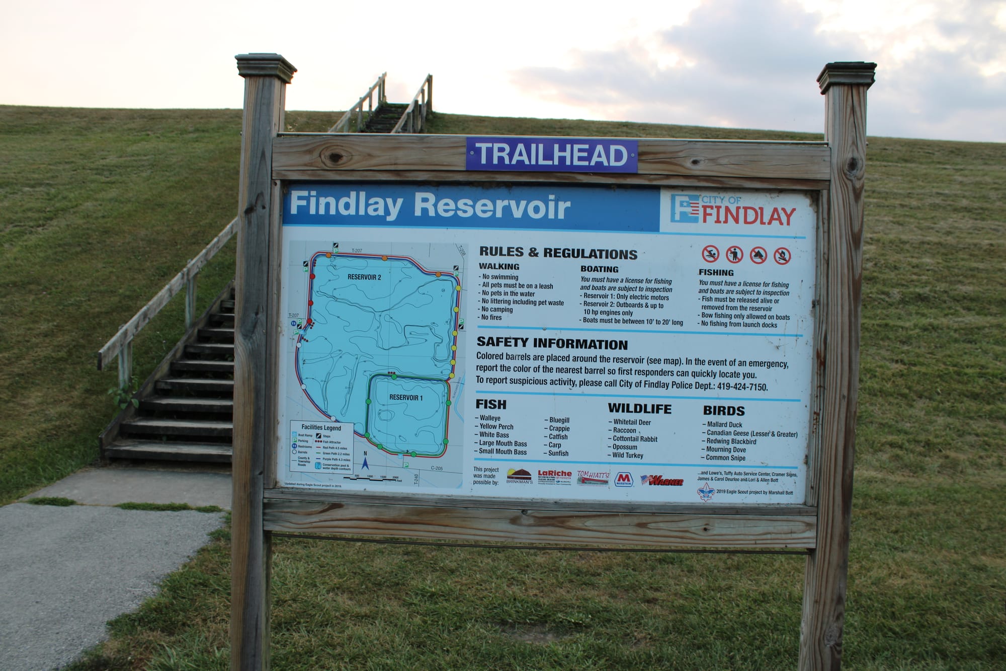
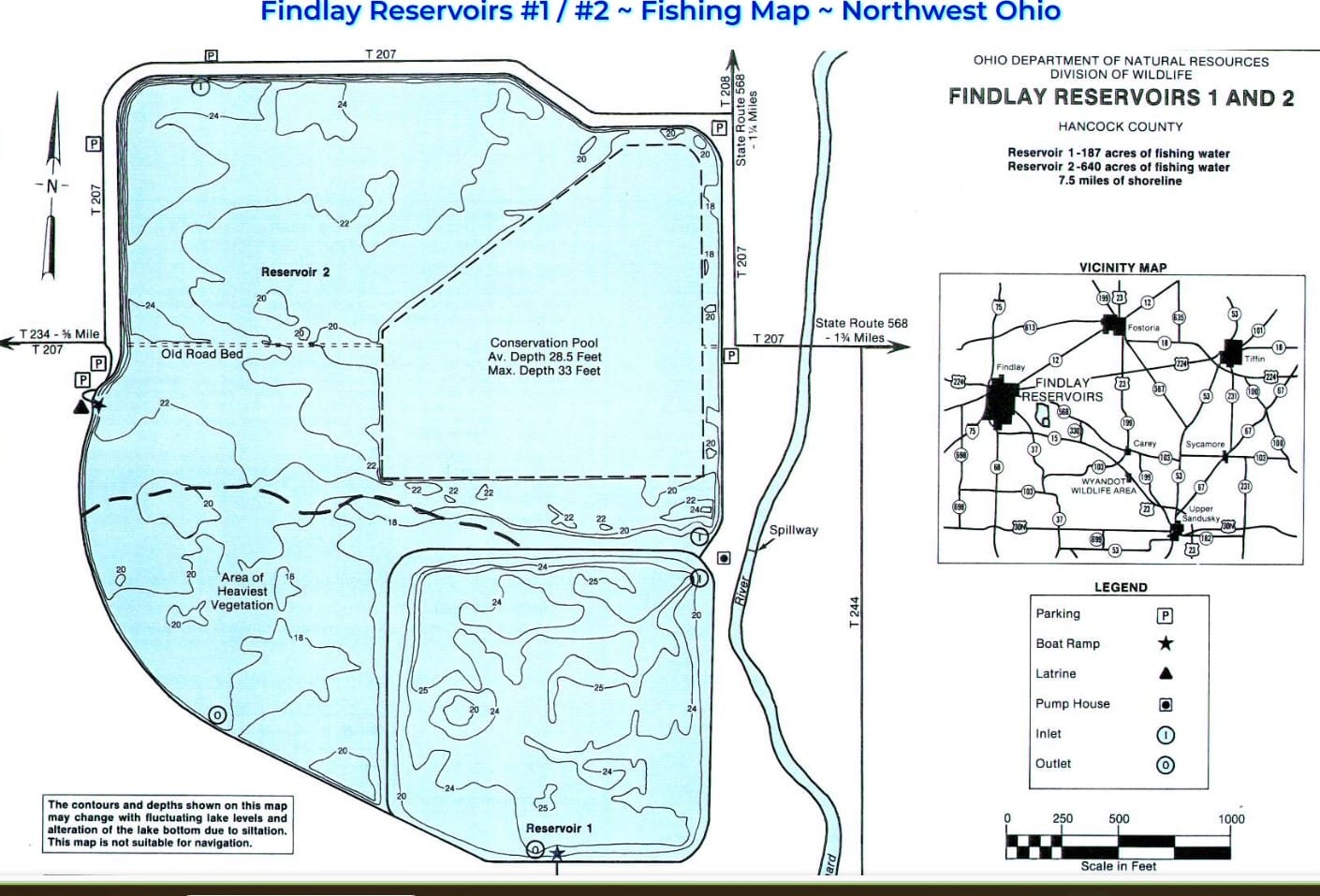
Findlay reservoirs 1 and 2 are up-ground reservoirs. Water is pumped from the adjacent Blanchard River into reservoir 2.
Reservoir 1 was built in 1950 by the City of Findlay as a municipal water supply. It has a surface area of 186 acres and a capacity of 1.4 billion gallons. The depths range from 20 to 28 feet and an average depth of 24 feet. There is little aquatic vegetative cover.
Reservoir 2 was built in 1968 as the first reservoir completed under the Northwest Ohio Water Development Plan. It was built to provide water to the City of Findlay, water for agricultural uses and recreation. Reservoir 2 was built cooperatively by the City of Findlay and Ohio Department of Natural Resources. Its surface area of 645 acres and capacity of approximately 5 billion gallons. Its depths range from 16 to 33 feet and an average depth of 24 feet.
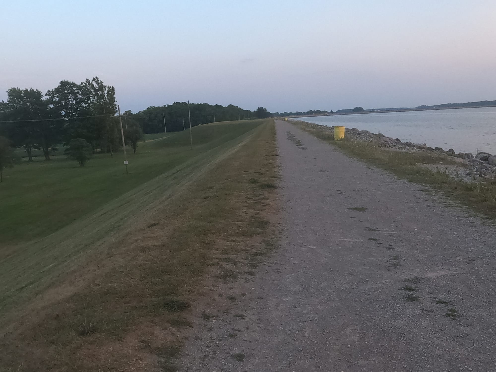
Findlay Reservoir 1 has 2 miles of diked shoreline, and Findlay Reservoir 2 has 4.3 miles of diked shoreline. These reservoirs share a common dike about 1 mile long. The distance around the outside perimeter of the combined reservoirs is 5.3 miles. These reservoirs have earthen dikes that are approximately 12 feet wide at the top with 2:1 slopes.
Hiking Trails:
The trails around Findlay Reservoir offer scenic views and a range of hiking experiences. Here’s a summary of some popular trails:
- Findlay Reservoir Trail
- Length: Approximately 3.5 miles (loop)
- Description: This trail loops around the reservoir, offering picturesque views of the water and surrounding natural areas. The terrain is relatively flat with some gentle inclines, making it accessible for hikers of all levels. It’s a good trail for walking, jogging, and birdwatching.
- East Shore Trail
- Length: About 2 miles
- Description: Running along the eastern shore of the reservoir, this trail provides scenic views and opportunities for wildlife observation. It is a fairly easy trail, suitable for casual hiking and enjoying nature.
- West Shore Trail
- Length: Approximately 1.5 miles
- Description: This trail follows the western edge of the reservoir, offering views of the water and surrounding greenery. It is shorter and less challenging, making it ideal for a quick hike or a leisurely walk.
- Reservoir Loop Trail
- Length: About 4 miles
- Description: This trail circles the reservoir and provides a comprehensive hiking experience around the entire water body. It features a mix of terrain and offers varied views of the reservoir and its natural surroundings.
Findlay Reservoir provides a range of hiking options and recreational opportunities in a serene setting. It’s a great spot for those looking to enjoy nature and get some exercise while being close to the city of Findlay.
Findlay Flooding:
Flooding has always been an issue for the City of Findlay. Fortunately, many flood mitigation techniques have been utilized to decrease flooding events impact.
1904 Flood:
The first recorded flood in the City of Findlay. There was a flood in January of 1904 but there is no record from the Morning Republican newspaper. Date April 1, 1904.
Estimated Amount of Damage: $80,000-$100,000
Crest Height: N/A
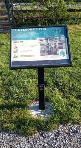
1913 Flood:
Findlay's 1913 flood is considered the worst flood in the city's history. Strong winds ripped the roofs off moving cars. 50 buildings in the city and county were unroofed. Because of the flooding, Findlay was disconnected from telegraph, phone, electricity, gas, and put a hold on newspaper production. One person was found dead once the water had subsided. March 21-26, 1937.
Crest Height: 18.5 ft
1937 Flood:
One of the most significant flooding events in Findlay's history occurred in January 1937. Heavy rainfall and melting snow led to severe flooding across the region. The Blanchard River, which runs through Findlay, overflowed its banks, causing extensive damage to homes, businesses, and infrastructure.
1947 Flood:
June 8th, 1947
"We anticipate a flood every time it rains" - Warren Krout
Crest Height: 13.73 ft
1950 Floods:
February 15 and November 21, 1950
Findlay was hit with its worst snowfall since 1913. A few days later, warm weather caused the snow to melt leading to the Blanchard River rise just over 11 feet.
Crest Height: 14.71 (2/15) and 11.28 (11/21
1957 Flood:
April 6, 1957
"Oh it's raining, I guess we should prepare for a flood" - Joy Bennett
Crest Height: 12.72
1959 Flood:
In February 1959, ice jams at the Main Street and Blanchard Street bridges caused significant flooding in Findlay, and portions of Hardin, Putnam, and Hancock counties suffered heavy damage from flooding of the Blanchard and Eagle Creek, a tributary. February 9-11, 1959
City officials were worried that the rapid water flow underneath the Main Street bridge would rupture a gas main. Evacuation centers were forced to evacuate because of the threats.
The 1959 flood caused the U.S. Army Corps of Engineers to begin researching methods to mitigate Findlay's flood risk.
Crest Height: 16.76 ft
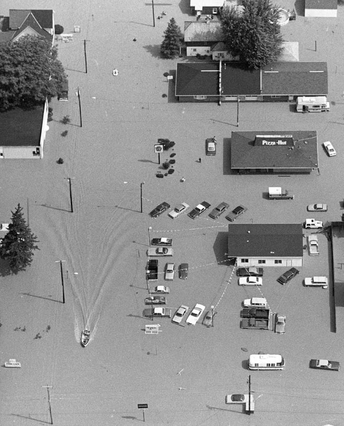
1981 Flood:
The flood of June 13-15, 1981, in the Blanchard River basin in northwestern Ohio caused major damage in Findlay, Ottawa, and adjacent rural areas. Approximately 25 percent of Findlay and 55 percent of Ottawa were flooded. Estimated crop damage was $12 million in Hancock Country, $7 million in Wyandot Country, and $3 million in Putnam Country.
The 1981 flooding followed an all-day, torrential downpour that closed roads and swelled streams throughout northwest Ohio and southeast Michigan.
The Flood of 1981 is considered to be the third worst flood in the history of Findlay. Damages were estimated to exceed $13.3 million. This flood affected 2,000 homes and 500 businesses.
President Ronald Reagan declares Hancock County a disaster area. This would open available government aid.
Crest Height: 17.43 ft
1990 Floods:
February 17 and December 31, 1990
"This doesn't even shock you anymore. It makes you mad, but it doesn't shock you." - Casey Hensley
Crest Height: 11.15 (2/17) and 14.85 (12/31)
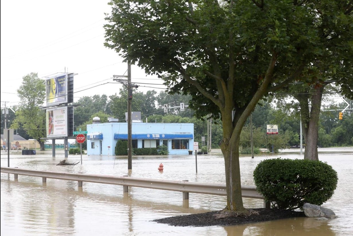
2007 Flood:
More recent flooding occurred in June 2007, caused by a combination of heavy rainfall and stormwater runoff. This event led to considerable damage in Findlay, including property damage and disruptions to daily life.
Findlay's worst flood since 1913. Excessive rain from Hurricane Erin resulted in rainfall ranging from five to nine inches. The City of Findlay declared this flood a civil emergency.
Over 2,600 Northwestern Ohio residents registered for assistance from FEMA. 1,600 Hancock County households were eligible for FEMA's Individual and Household Program. FEMA approved over $6 million in grant funding for Findlay's flood victims.
Crest Height: 18.46 ft
2008 Floods:
January 10 and February 7, 2008
While the village was still working to recover from the great flood the previous year, they were hit with two additional floods. These flooding events showed the significant need for local action to mitigate the flood risk.
Crest Heights: 11.23 (1/10) and 16.5 (2/7)
2009 Floods:
March 9, 2009
"People who live here understand it's going to flood." - local business owner Jack Bindel.
Crest Height: 15.41
2011 Floods:
March 1, 2011
The 2011 flood had potential to be much more devastating. Findlay residents were worried this flood would mirror the damages from the 2007 flood. Flood awareness and taking proper precautions helped minimize the losses.
"It always could be worse, we dodged a bullet" - Mayor Pete Sehnert
Crest Height: 16.42 ft
2013 Floods:
April 12, July 22, and December 22, 2013
The Blanchard River flooded three times in 2013. The worst flooding was on December 22, nicknamed the Christmas Flood. Just like in 1950, a heavy snowfall followed by sudden warm temperatures lead to major flooding.
Crest Heights: 14.1 (4/12), 12.43 (7/11), 15.58 (12/22)
2017 Flood:
July 13, 2017
The most recent flooding event reached the 5th highest levels in the city's history.
Crest Height: 16.53 ft
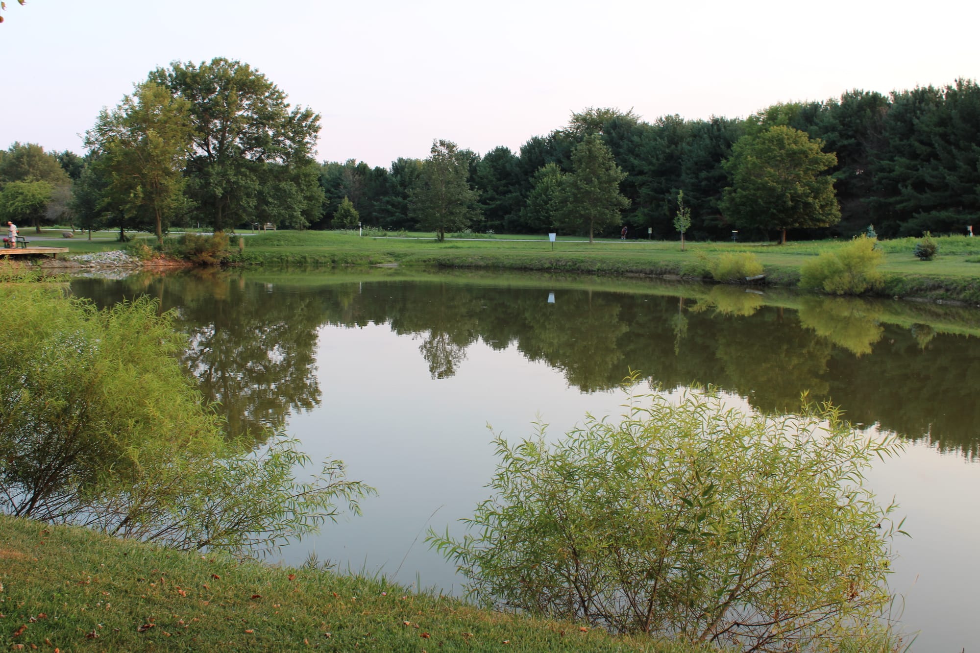
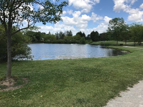
Recreation:
The Findlay Waterworks Reservoir continues to be a vital component in managing water resources and addressing flood risks for the city of Findlay, while also providing opportunities for recreational enjoyment.
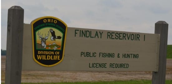
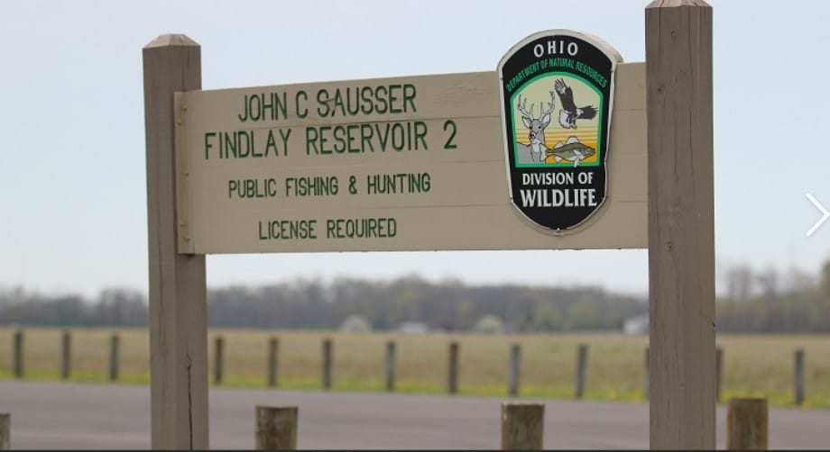
Both reservoirs are open to public fishing through a cooperative agreement between the City of Findlay and the Ohio Department of Natural Resources Division of Wildlife.
Fishing License Options
Annual fishing licenses are valid for 365 days from the date of purchase. Annual and multiyear fishing licenses are valid from the date of purchase until the expiration date printed on the license. Please access the Ohio Department of Natural Resources to purchase a fishing license.
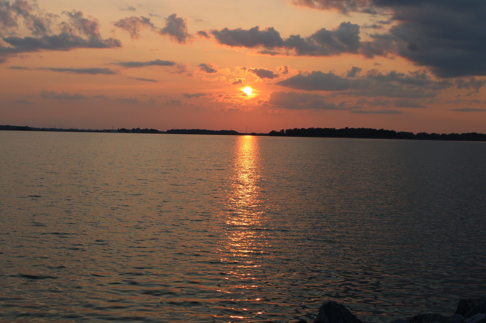
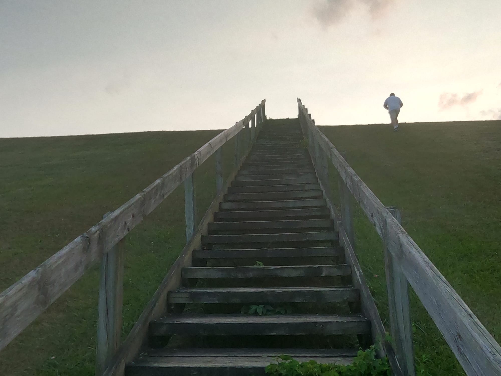
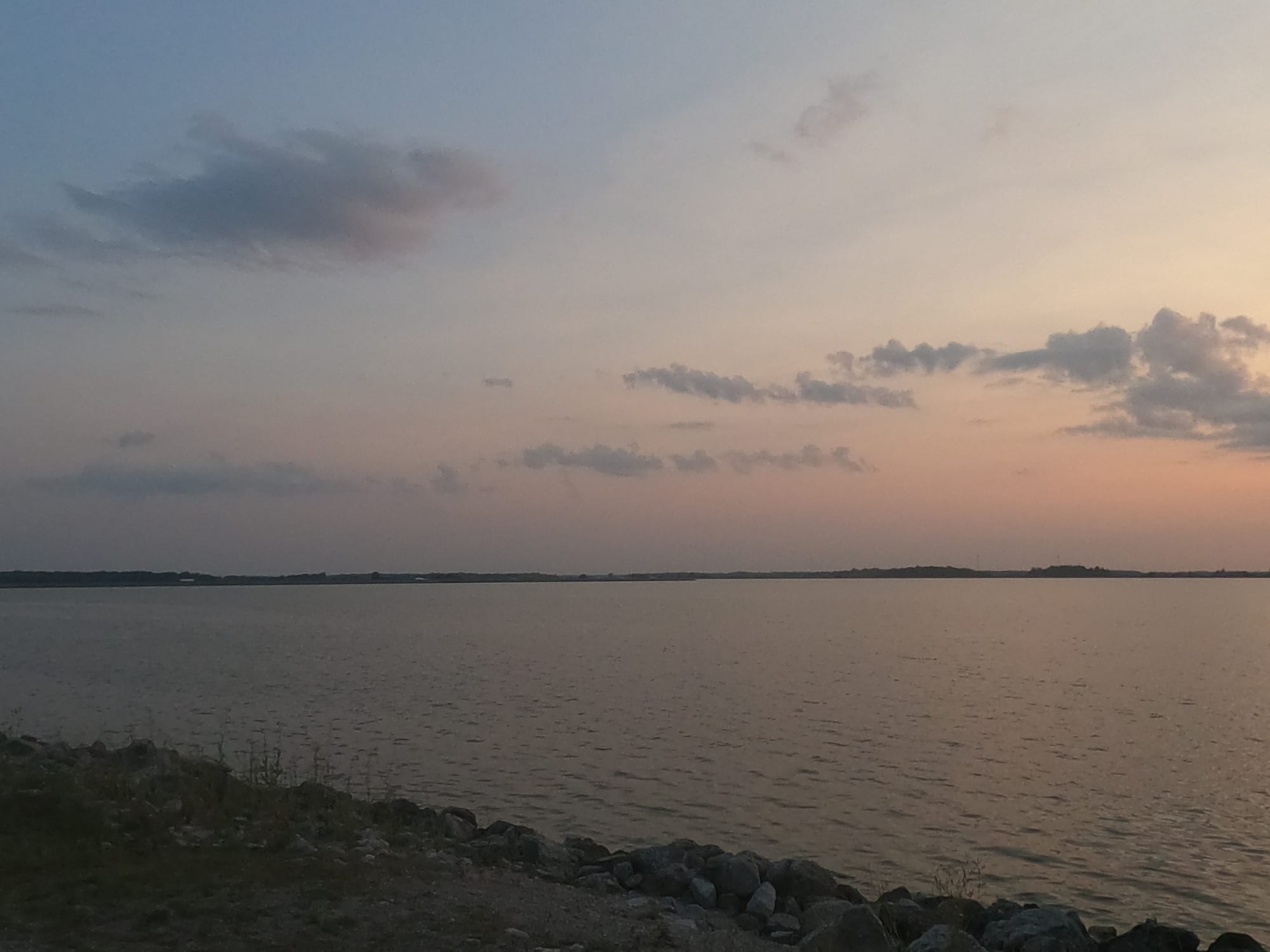
https://ohiodnr.gov/homeRiverbend Recreation Area-Oxbow:
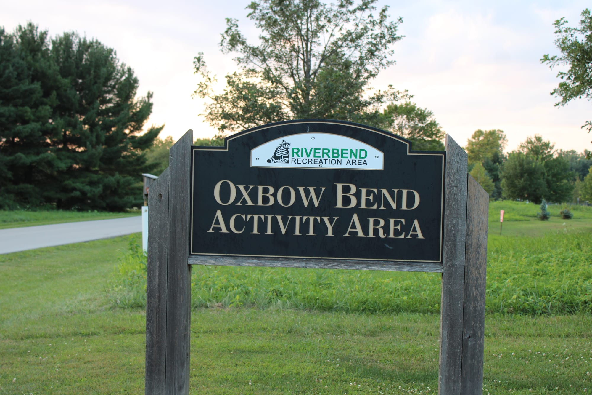
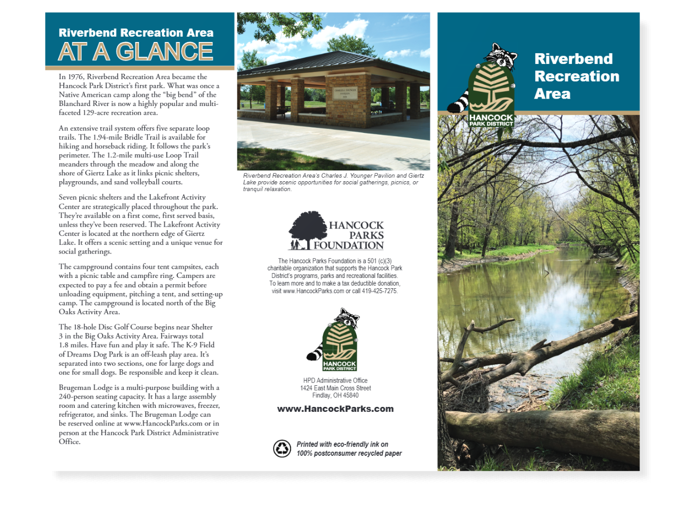
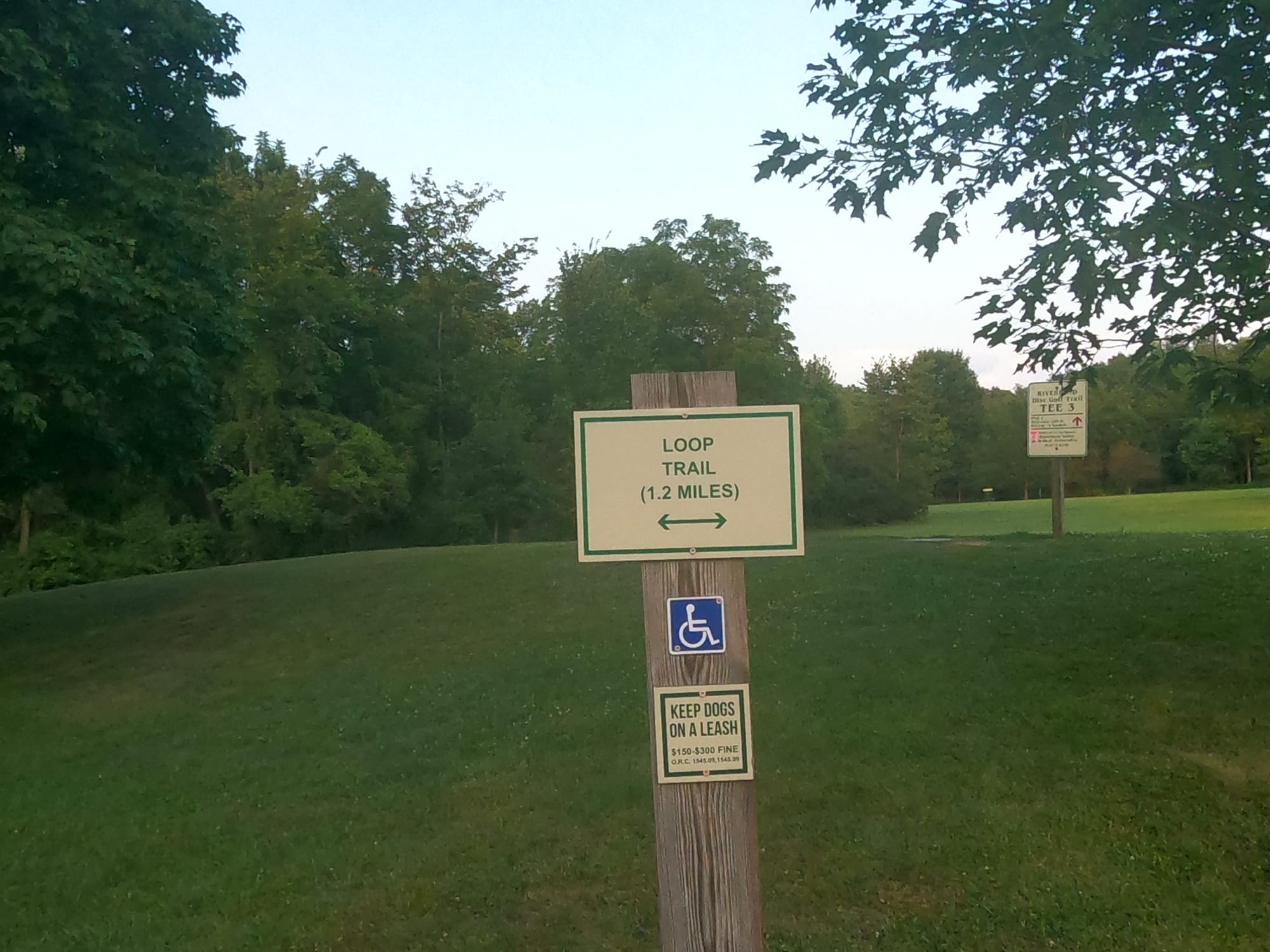
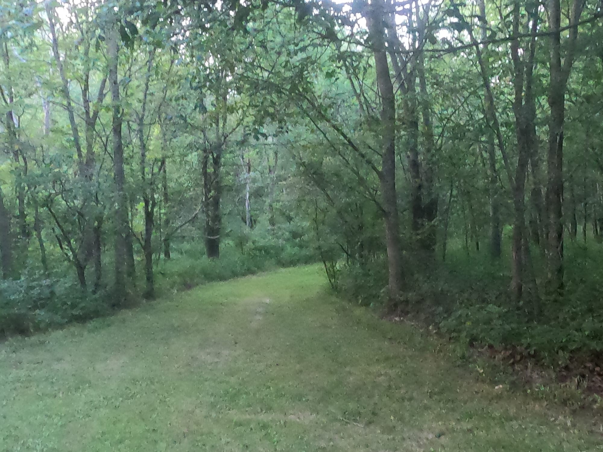
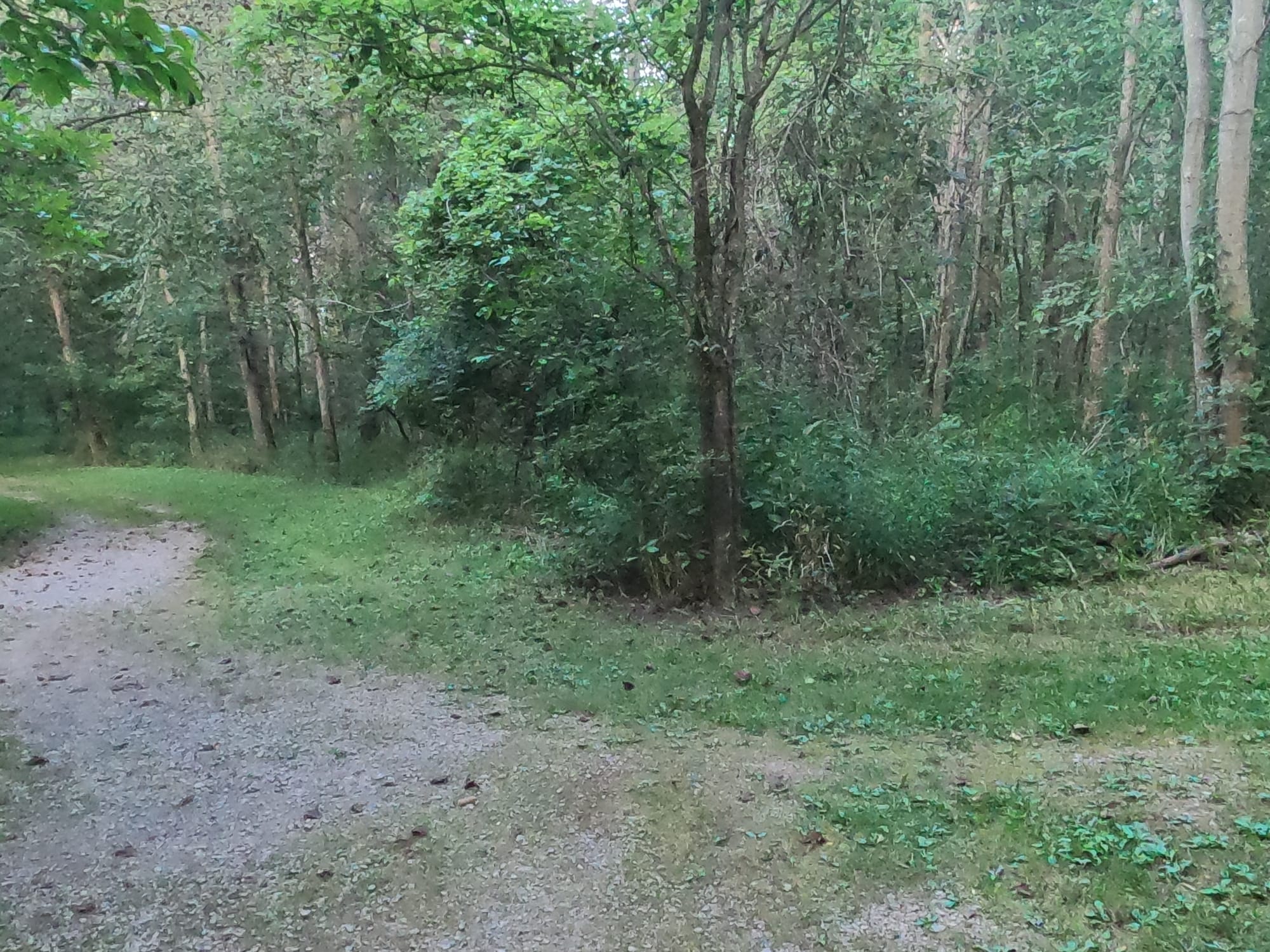
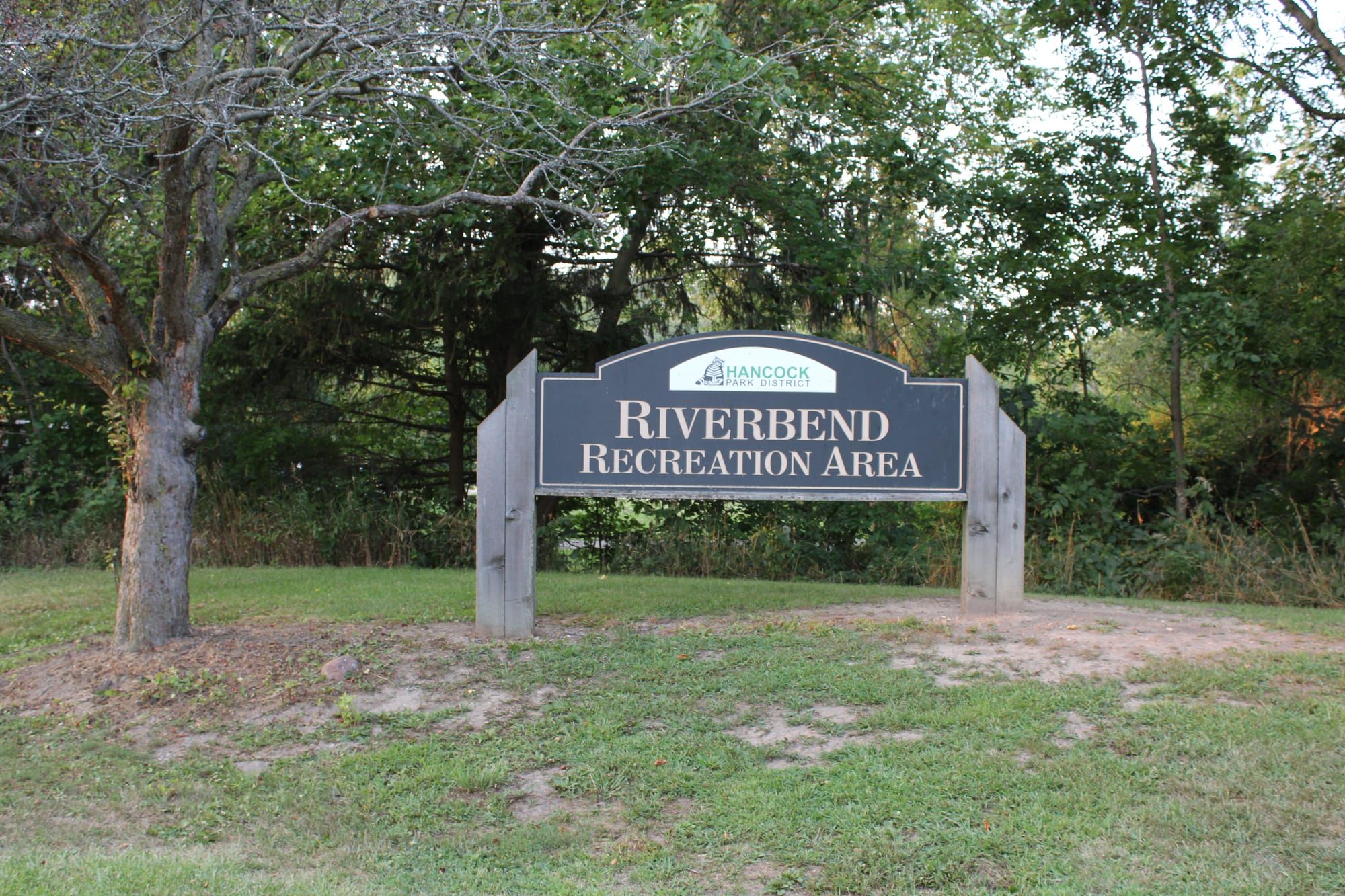
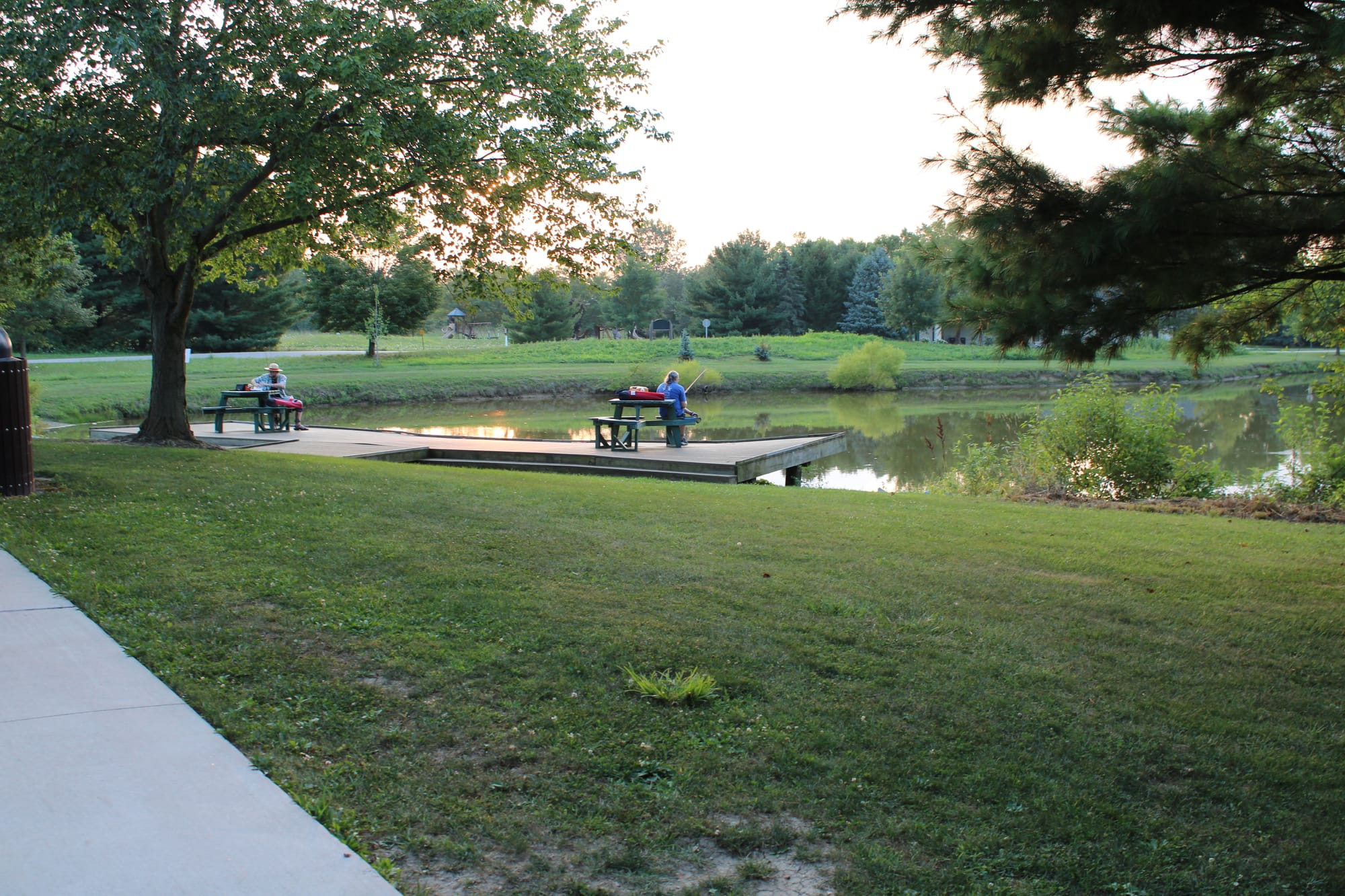
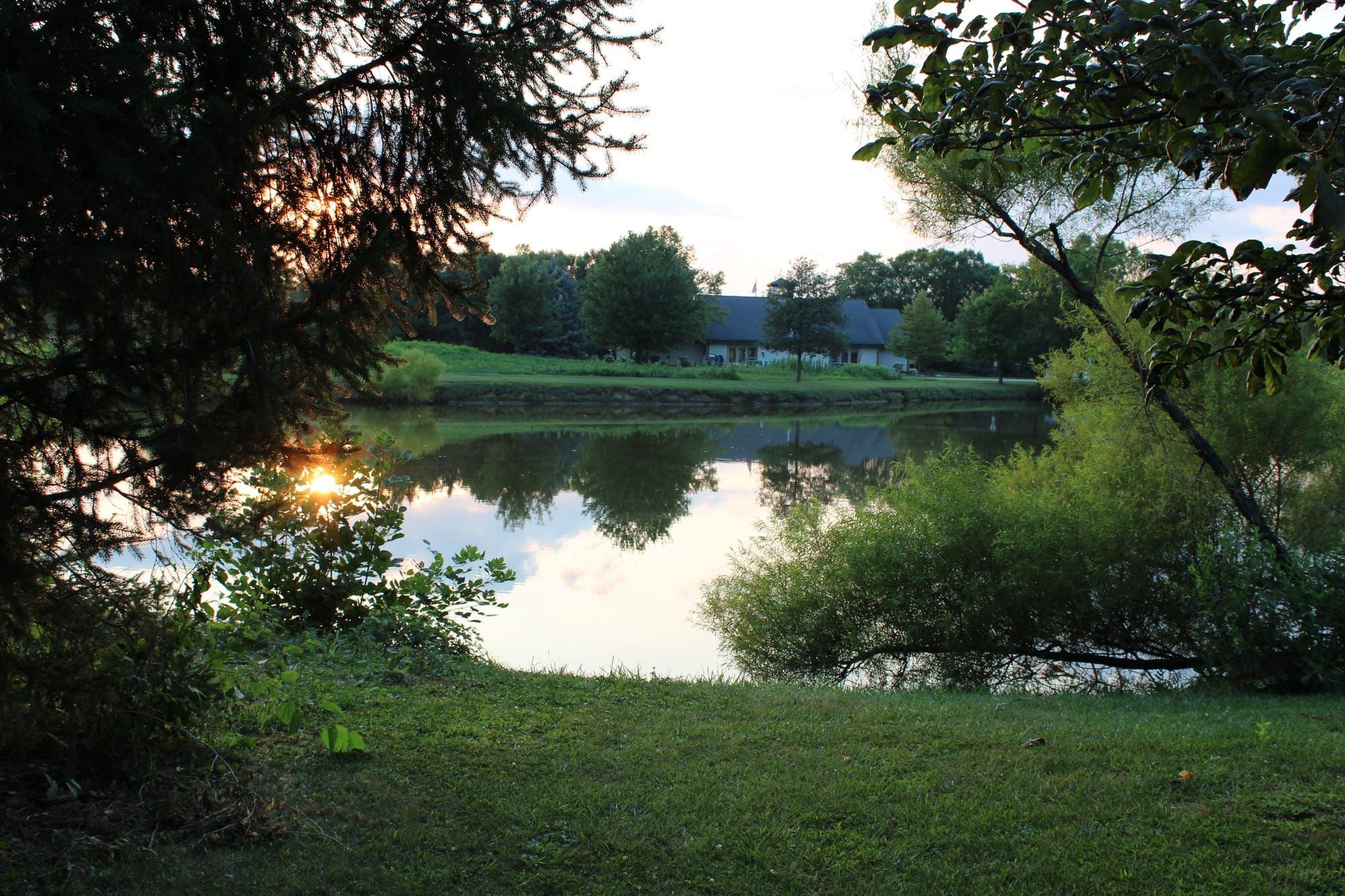
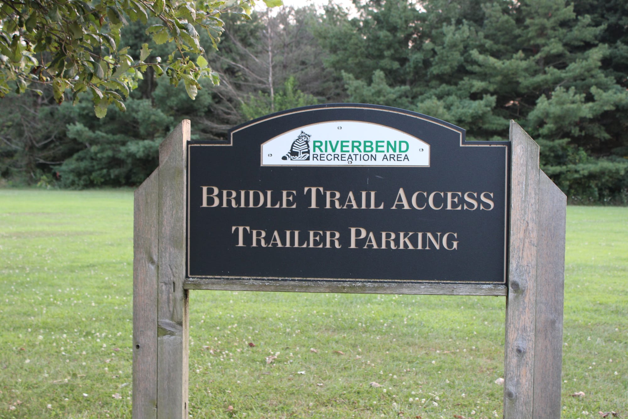
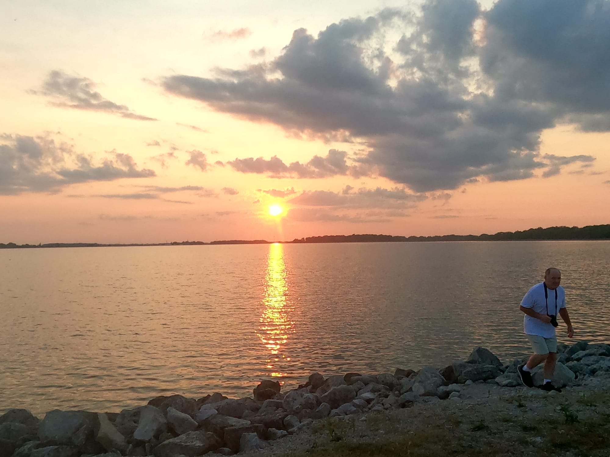
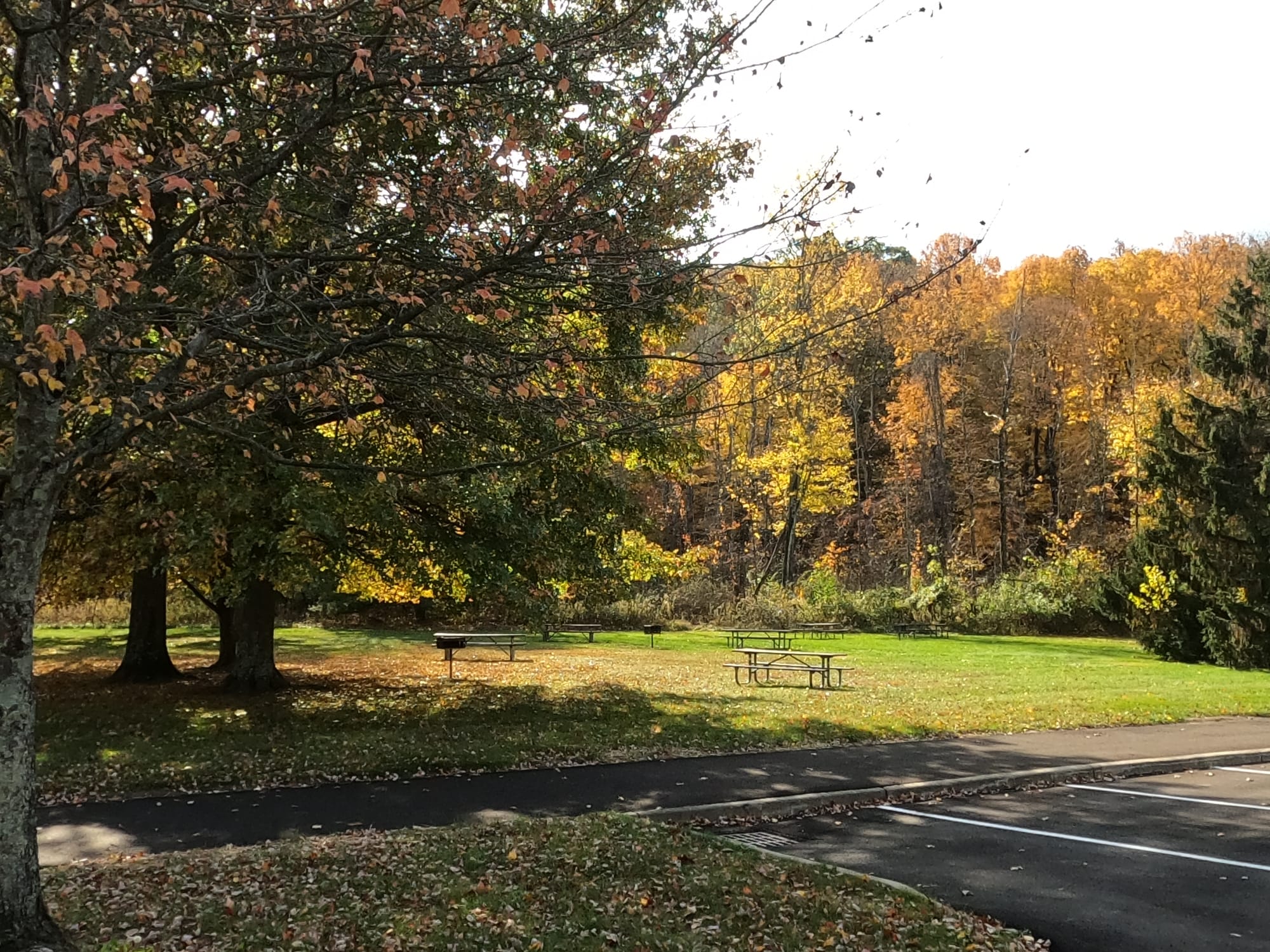
We visited the Findlay Reservoirs and Oxbend Recreation this past summer. It was near sundown and are hike up the steps to the hiking trail was really worth it. We also did a short hike in the Oxbend Recreation Area. Information about the Riverbend Recreation Area is above.
Conclusion:
Though we didn't have a great amount of time to spend at the Findlay Reservoirs it is definitely an area we would like to return to visit. Since we also enjoy fishing it appears to be a good area to enjoy fishing as well.
If you are in the Findlay, Ohio, area, it is worth stopping by to experience what the Findlay Reservoirs and the Riverbend Recreation Area have to offer.
If you have any questions or would like to contact us, please let us know.
More in
Homestead Metro Park: Trails, Map & Hiking Guide
Homestead Metro Park in Columbus, OH: 2.5-mi easy loop, 80 ft gain, 1.2 hrs. Dog & kid-friendly trails with fishing pond. Full hiking guide & directions.
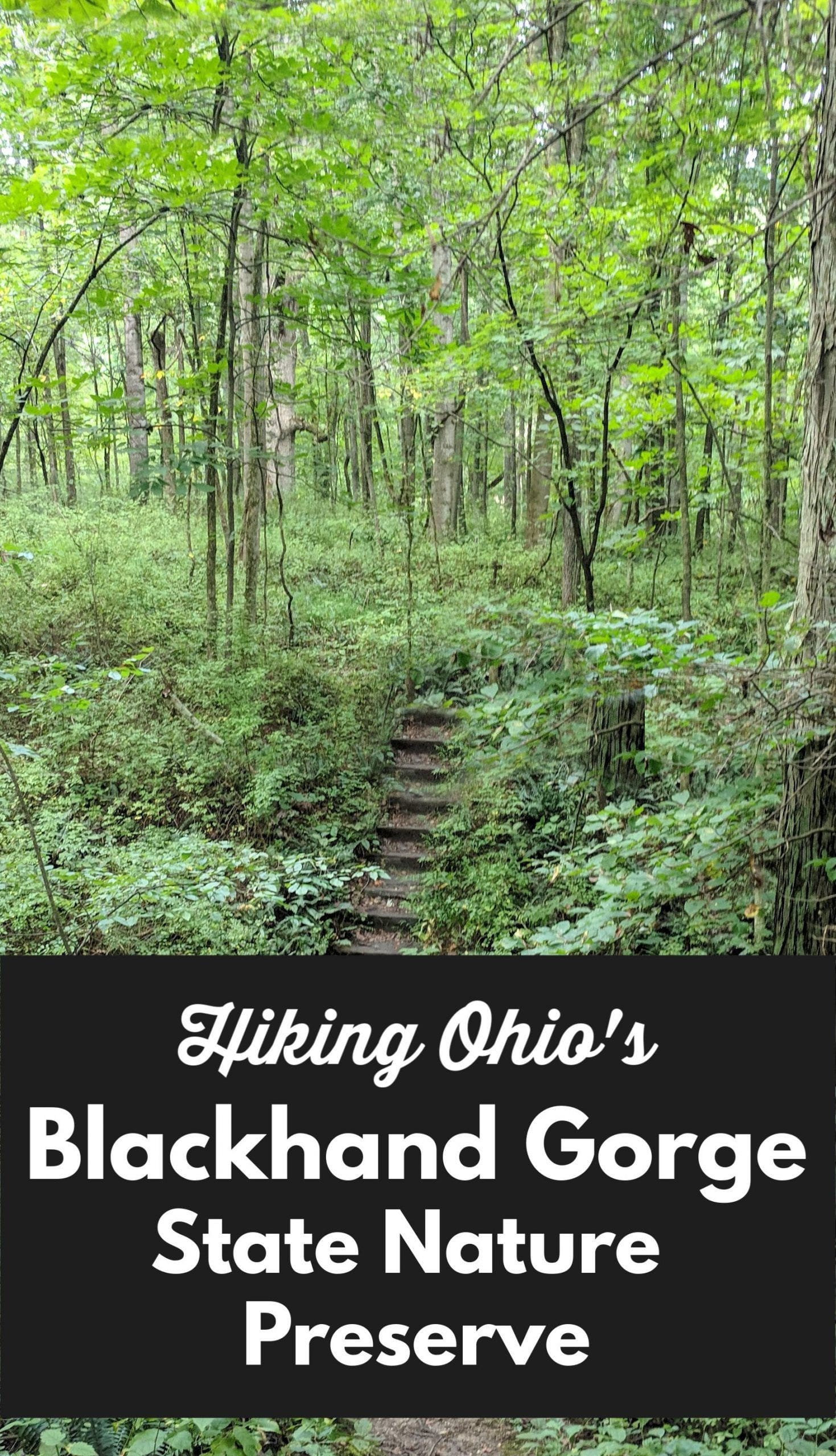
Blackhand Gorge State Nature Preserve
Blackhand Gorge State Nature Preserve: 4.3-mi out-and-back, 150 ft gain, 2 hrs. Scenic gorge & wildlife near Newark, OH. Full hiking guide & trail map.
Chestnut Ridge Metro Park: Columbus Trail Guide 2026
Chestnut Ridge Metro Park near Groveport, OH: 2.5-mi loop, 150 ft gain, 1.2 hrs. Forested ridge, scenic overlooks & wooded trails near Columbus. Trail map.