Pictured Rocks National Lakeshore
Trail Map
Interactive map showing the trail route for Pictured Rocks National Lakeshore. The map displays topographic information and trail markers.
Elevation Profile
Elevation data not available for this trail.
Chart showing elevation changes along the trail distance. Hover or focus on the chart to see specific elevation values at each point.
Pictured Rocks
National Lakeshore
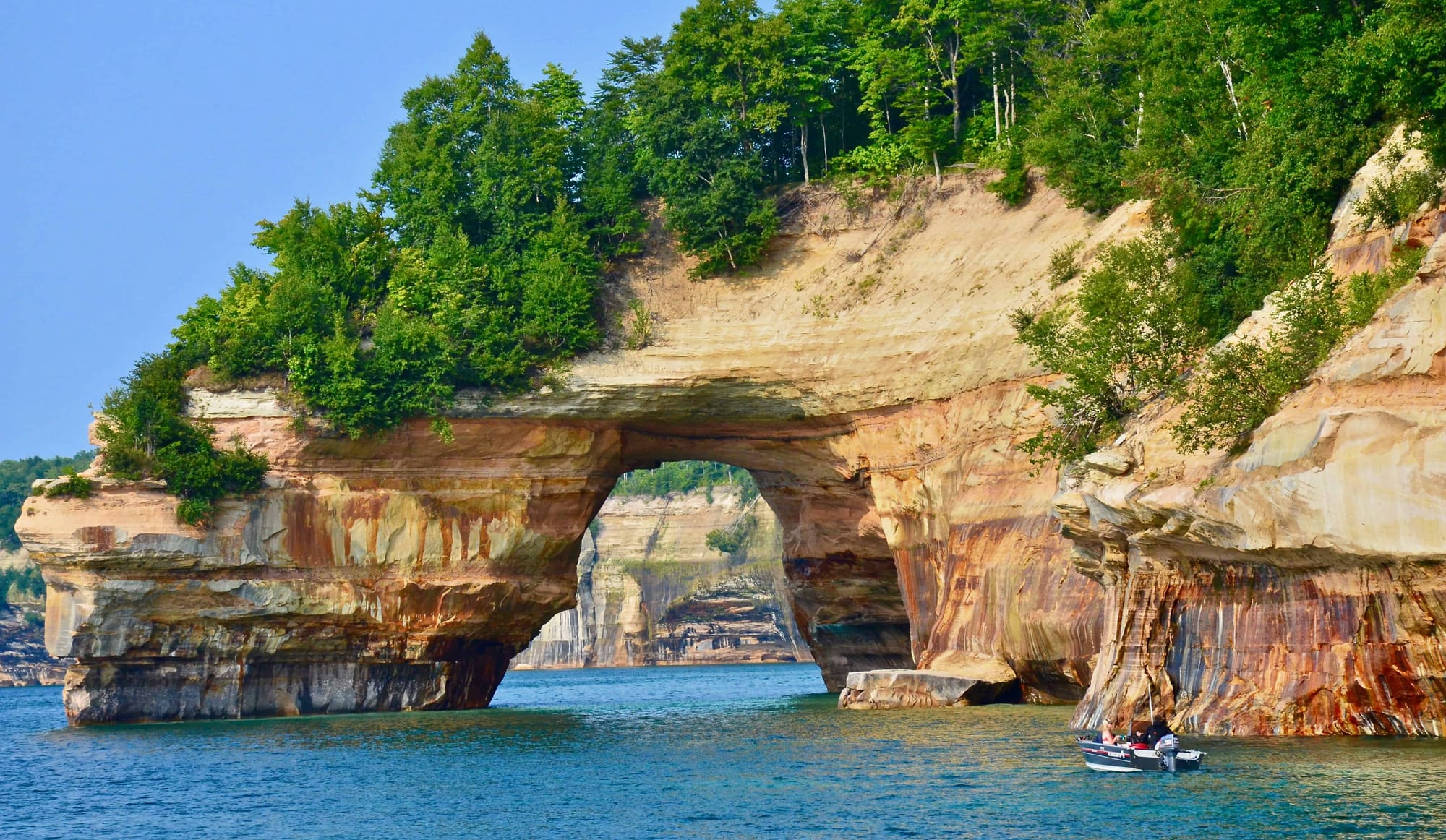
Pictured Rocks National Lakeshore was established as the first national lakeshore in the U.S. on October 15, 1966. It is not a national park but is managed by the National Park Service. The lakeshore is located along 42 miles of Lake Superior’s shoreline in Michigan’s Upper Peninsula and covers 73,236 acres. The park is famous for its vibrant hues, thanks to mineral deposits that paint the rocks in shades of orange, green, and blue.
Lake Superior is the largest of the Great Lakes. The park is famous for its vibrant hues, thanks to mineral deposits that paint the rocks in shades of orange, green, and blue. It is the largest freshwater lake by surface area in the world. Near Pictured Rocks, Lake Superior:
- Has an average depth of 483 feet and a maximum depth of 1,333 feet
- Has a surface area of about 31,700 square miles
- Contains 10% of the world's fresh surface water.
- Stretches for about 350 miles in length and 160 miles in width.
Admission and Fees:
- Entry Fee: As of 2024, the entrance fee for Pictured Rocks National Lakeshore is:
- Private Vehicle: $25 for a 7-day pass.
- Motorcycle: $20 for a 7-day pass.
- Individual: $15 for a 7-day pass (for pedestrians, bicyclists, or people entering the park by other non-motorized means).
- Annual Pass: There is also an option for an annual pass for $45, which covers entrance to the park for one year from the date of purchase.
- Free Days: The National Park Service offers several "fee-free" days each year, where visitors can enter the park without paying the usual entrance fee. These days are typically aligned with specific federal holidays.
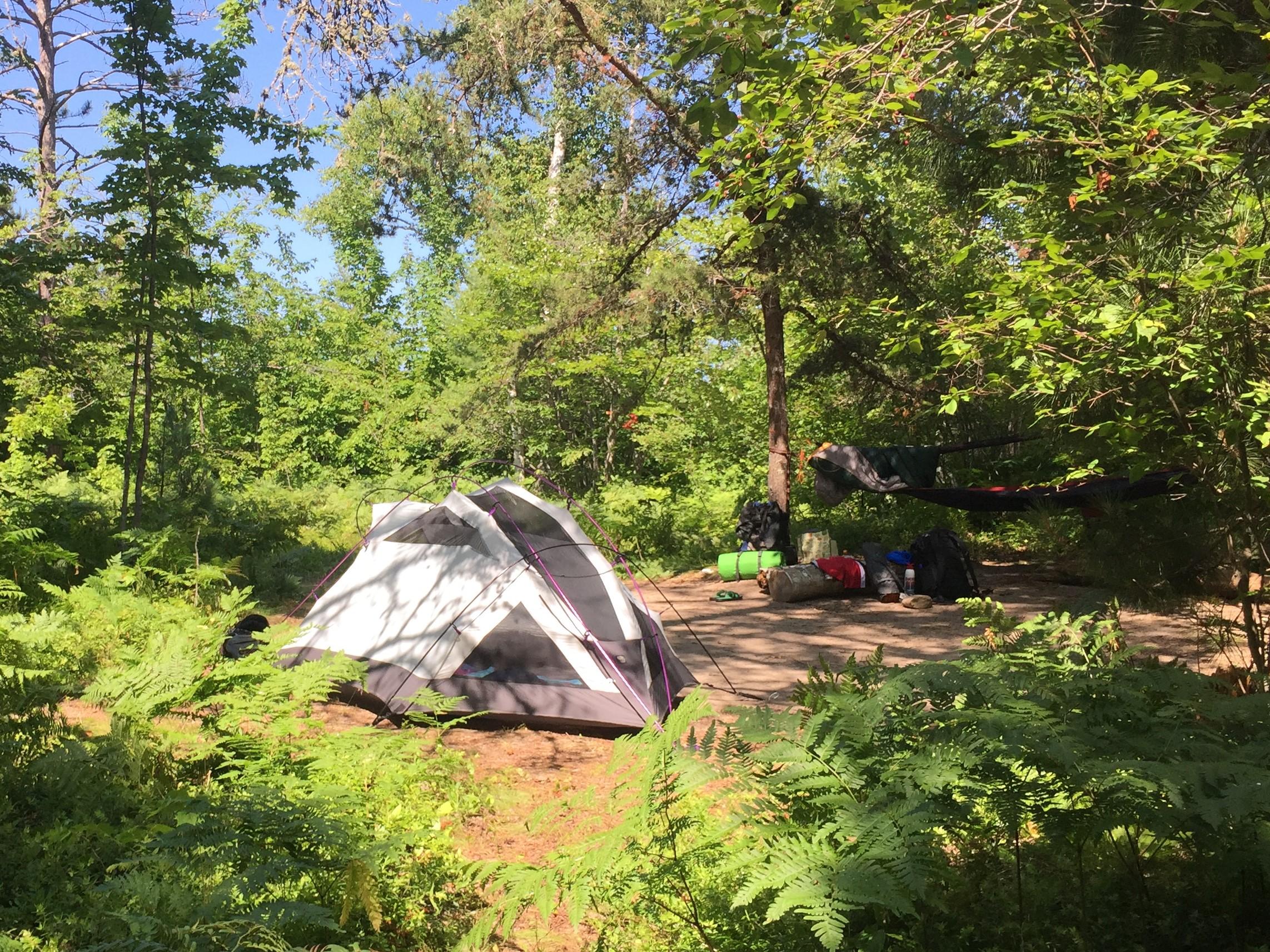
- Camping: There are several campgrounds in the area, including both front-country and backcountry sites. Permits and reservations are required for backcountry camping.
Visitor Centers:
The main visitor center is located in Munising, where you can find maps, exhibits, and information about the park. It’s a great starting point for planning your visit.
P.O. Box 40
Munising, MI 49862

Phone:
906-387-3700
Munising Falls Visitor Center
Things to do
- Outdoor Activities: Visitors can enjoy a variety of outdoor activities, such as:
- Hiking: There are several hiking trails of varying difficulty, including the popular Chapel Rock Trail.
- Fishing and Swimming: Lake Superior provides opportunities for fishing, though the cold waters limit swimming.
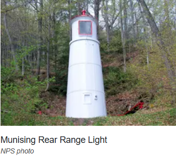
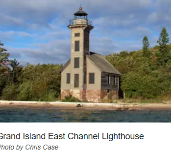
- Lighthouses: Scattered around the area.
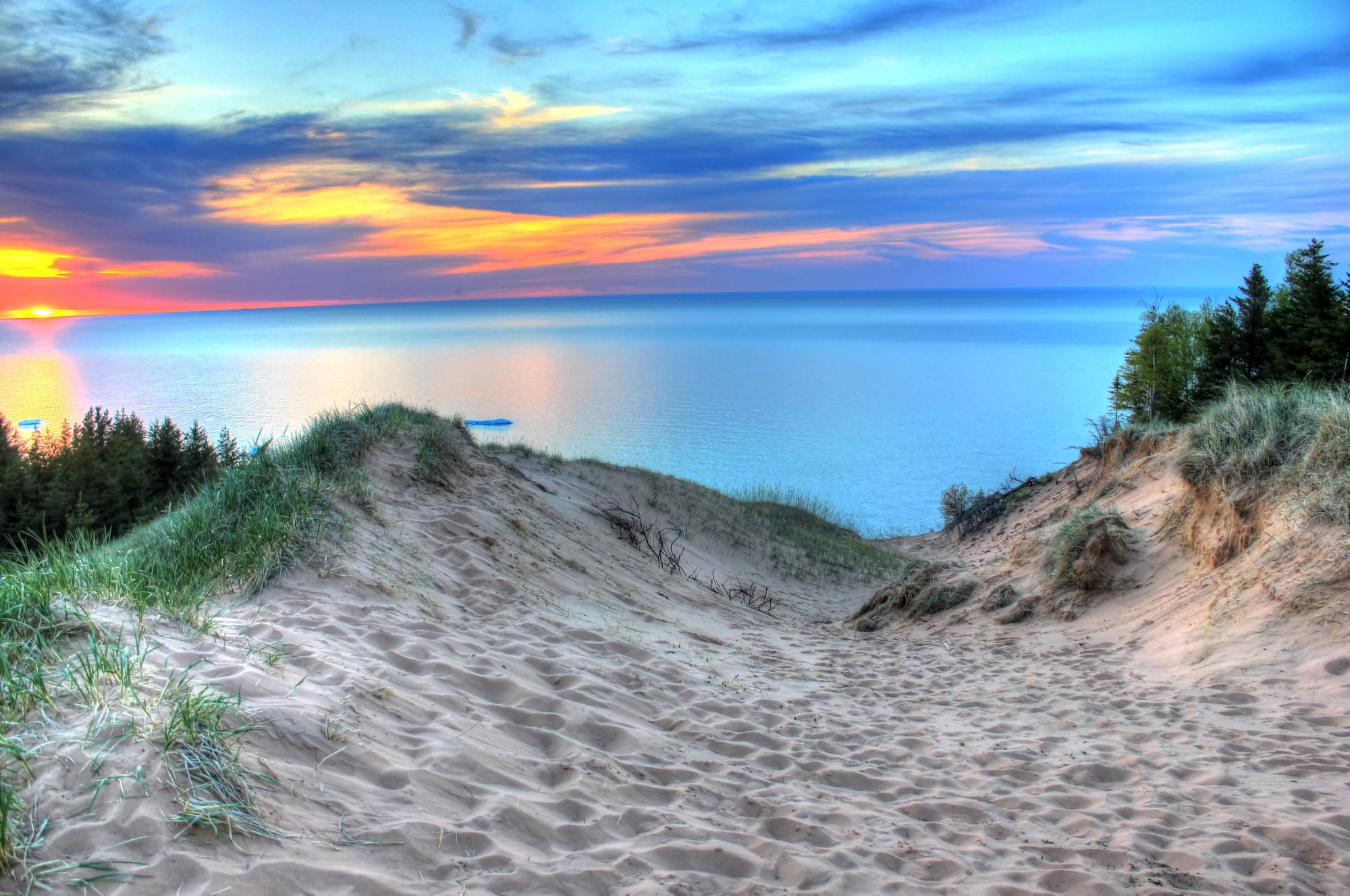
- Dunes: To climb and explore
- Camping: Wonderful campsites in the area
- Picnicking: Many fine areas to relax
- Waterfalls and Scenic Views: Many sites to see.
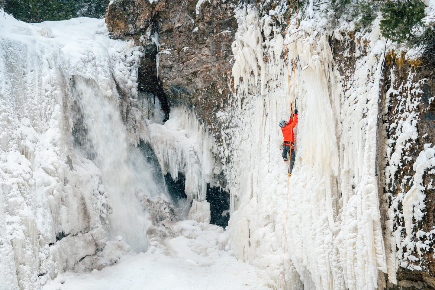
- Snow Activities: Plenty to do if you like the cold!
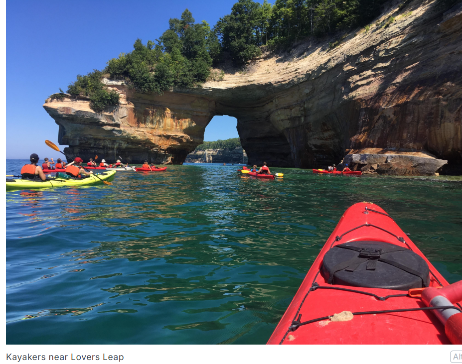
- Kayaking and Canoeing: Renting a kayak or canoe lets you glide along the lakes and rivers, giving you a whole new perspective of Pictured Rocks.
Hiking Trails:
Pictured Rocks National Lakeshore in Michigan offers a variety of hiking trails that cater to different experience levels, showcasing stunning views of the Lake Superior shoreline, cliffs, forests, waterfalls, and more. Here's a summary of some of the most popular hiking trails, their lengths, difficulty levels, and key features:
1. Chapel Rock and Chapel Falls Trail
- Length: 2 miles (round trip)
- Difficulty: Easy to Moderate
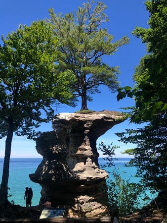
- Description: This trail is one of the most popular in Pictured Rocks, offering scenic views of Chapel Falls, a picturesque waterfall. The trail also leads to the famous Chapel Rock, a rock formation with a tree growing from it. The trail is mostly moderate but does have some elevation gain towards Chapel Rock. There are several views of the surrounding area, making this a beautiful and relatively short hike.
- Key Features: Chapel Falls, Chapel Rock, and views of the Lake Superior shoreline.
2. Miners Castle Trail
- Length: 0.7 miles (round trip)
- Difficulty: Easy
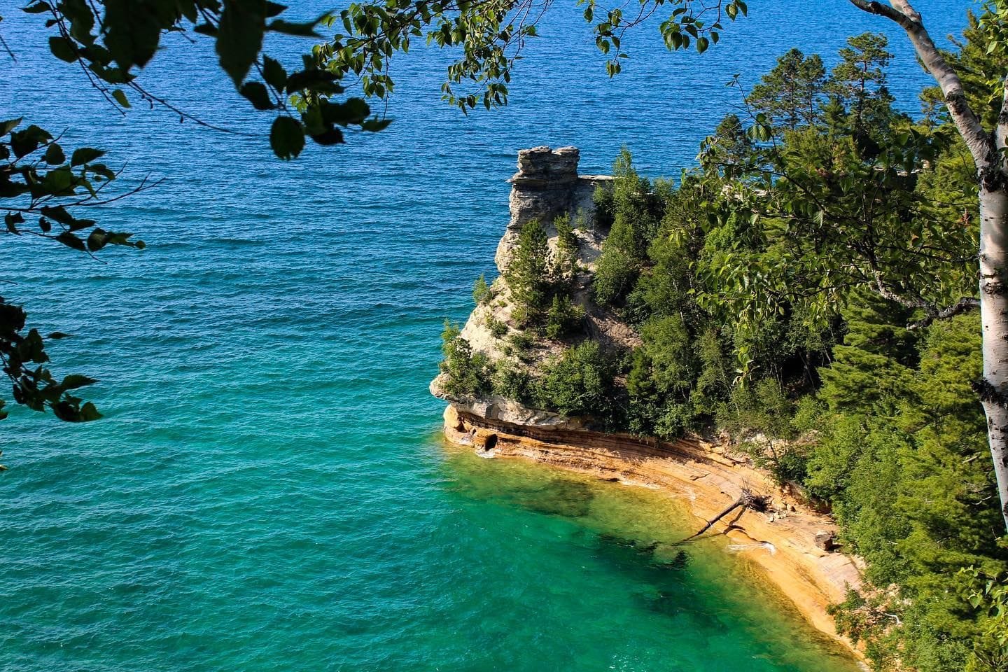
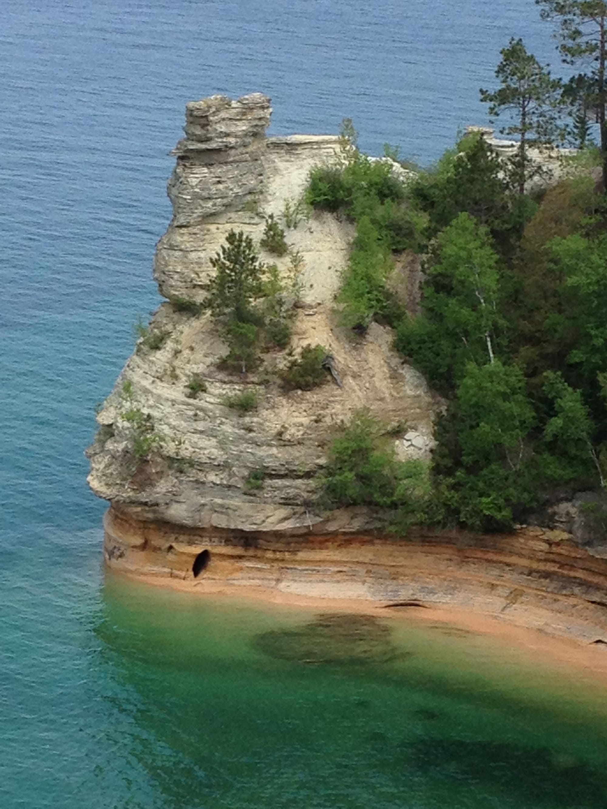
- Description: This short trail offers easy access to one of the most iconic features of Pictured Rocks, Miners Castle, a rock formation resembling a castle. It’s a relatively flat trail that takes you to a viewpoint overlooking the formation and Lake Superior. Although short, it provides stunning views and is a great option for families or those with limited time.
- Key Features: Miners Castle formation and panoramic views of Lake Superior.
3. Miner's Beach to Miners Castle (South Trail)
- Length: 1.5 miles (round trip)
- Difficulty: Moderate
- Description: This trail starts at Miners Beach and follows the shoreline to the Miners Castle viewpoint. It offers a more rugged hike compared to the paved or well-maintained trails, with some rocky sections. The trail provides great views of the cliffs and shoreline along the way.
- Key Features: Views of the cliffs, Miners Beach, and the Miners Castle formation.
4. Twelve Mile Beach Trail
- Length: 1.5 miles (one way)
- Difficulty: Moderate
- Description: This relatively short but scenic trail takes you along Twelve Mile Beach and offers a tranquil hike along Lake Superior. It’s not as well-known as some of the other trails but provides a peaceful experience. The path offers views of the beach, forests, and some unique rock formations.
- Key Features: Lake Superior beach views, coastal forest landscapes.
5. North Country Trail (Pictured Rocks Segment)
- Length: 42 miles (within Pictured Rocks, can be hiked in sections)
- Difficulty: Moderate to Strenuous
- Description: The North Country Trail is a long-distance trail that passes through Pictured Rocks National Lakeshore. The segment within the lakeshore offers stunning views of the cliffs, forests, and the Lake Superior shoreline. The trail is often remote, with some areas requiring more effort due to elevation changes and uneven terrain.
- Key Features: Panoramic lake views, cliffside vistas, varied forest landscapes.
6. Mosquito Falls Trail
- Length: 2.5 miles (round trip)
- Difficulty: Moderate
- Description: This trail leads you through the woods to the beautiful Mosquito Falls. The path is a bit more challenging due to uneven terrain and some muddy sections, but the falls are a rewarding sight. It’s a great option for those who enjoy quiet, forested hikes.
- Key Features: Mosquito Falls, dense forests, and a serene natural environment.
7. Sable Falls Trail
- Length: 0.4 miles (one way)
- Difficulty: Easy to Moderate
- Description: A short but very scenic trail that leads to Sable Falls, one of the park’s most beautiful waterfalls. The trail is fairly easy but has some elevation changes as you descend to the falls. It's a great option if you're looking for a quick but rewarding hike.
- Key Features: Sable Falls and surrounding forest views.
8. Grand Sable Dunes Trail
- Length: 1.5 miles (round trip)
- Difficulty: Moderate to Strenuous
- Description: This trail takes you through the Grand Sable Dunes, offering views of both the Lake Superior shoreline and the sandy dunes. The trail includes some steep sections, but hikers are rewarded with panoramic views of the lake and the surrounding dunes. It's a great hike for those looking for a bit more of a challenge.
- Key Features: Grand Sable Dunes, views of Lake Superior, and unique dune landscape.
9. Log Slide Trail
- Length: 0.8 miles (round trip)
- Difficulty: Moderate
- Description: This trail is relatively short and leads to a viewpoint above the Grand Sable Dunes. The path involves a steep descent to the dunes, providing expansive views of the shoreline. It's a moderate hike with some challenging sections due to the elevation changes.
- Key Features: Views of the Grand Sable Dunes, the shoreline, and Lake Superior.
Geological Formation:
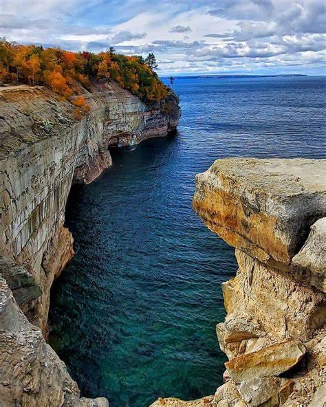
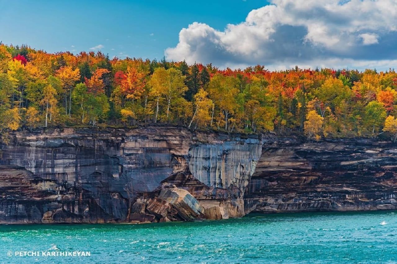
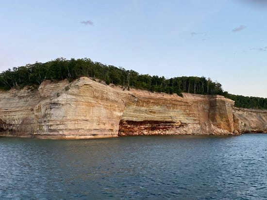
The name "Pictured Rocks" comes from the dramatic cliffs of multicolored sandstone that rise up to 200 feet above Lake Superior. These cliffs are formed by layers of sedimentary rock, including iron, copper, and other minerals, which have been stained by natural processes like water erosion and the action of waves and wind. Over thousands of years, the erosive forces of Lake Superior have created the distinct shapes, arches, caves, and waterfalls that make this area famous.
Human History:
- Indigenous Peoples: For thousands of years, the area was inhabited by Native American tribes, particularly the Anishinaabe (Ojibwe, Odawa, and Potawatomi). These tribes had a deep connection to the land and Lake Superior, and their culture and spiritual practices were closely tied to the region.
- European Exploration: European explorers, including French missionaries and fur traders, arrived in the early 17th century. The region became part of the fur trade network, and later, industrialization and settlement had an impact on the local environment.
Maritime Shipwrecks:
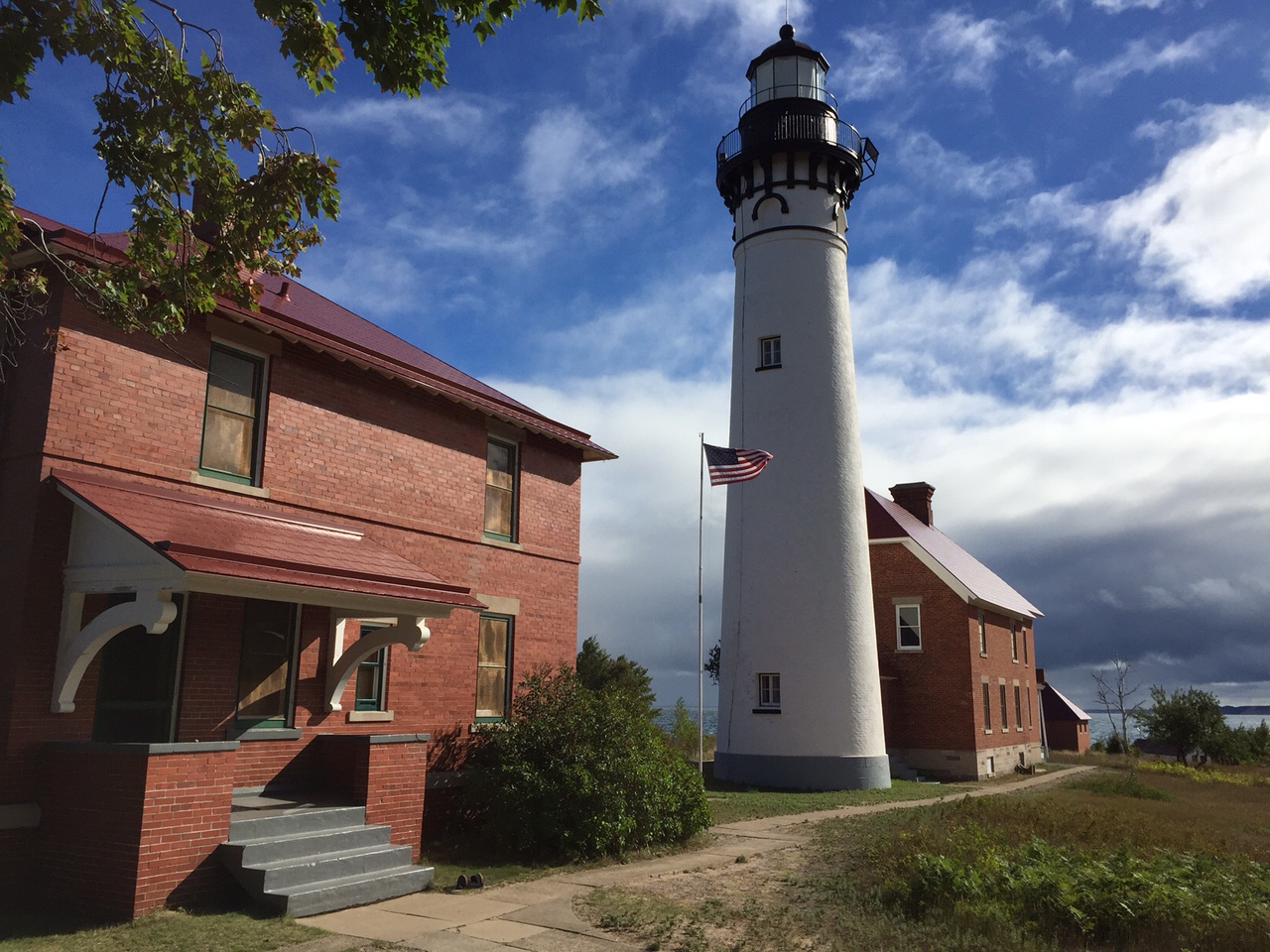
In the late 1800s and early 1900s, logging and mining in the Upper Peninsula was booming. This increase in traffic quickly lead to more maritime accidents and shipwrecks, which in turn created a need for the U.S. Lifesaving Service and the U.S. Lighthouse Service - later turned the U.S. Coast Guard - on the Great Lakes. What is now Pictured Rocks National Lakeshore was an especially treacherous section of Lake Superior due to the difficulty of the adjacent terrain and severity of storms. There are several de-commissioned U.S. Coast Guard stations and buildings throughout the park, including the Au Sable Light Station.
Logging:
The logging industry was a prevalent one in this area in the early 1900s. Today, little evidence remains of the structures they used, though an area once used for sending logs down to Lake Superior - Log Slide - remains a popular scenic site.
In the 1840’s, traditional supplies of New England white pine had been exhausted and new sources were sought for the growing nation. The next state with large forests of the valuable white pine was Michigan. Waterways also transported the finished product from the mills to markets on the lower lakes.
Pine was popular with the loggers because it floated easily and thus could be driven down rivers and streams to the mills or assembled into rafts and transported over the open lakes.
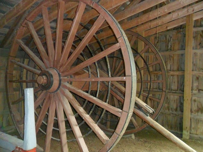
Three Michigan inventions of the 1870s were responsible for increasing the transportation of logs regardless of the weather. The first of the innovations called “big wheels,” was invented by Cyrus Overpack of downstate Manistee. These ten feet diameter wheels were pulled by a team of oxen or horses and allowed rapid movement of logs without the need for snow cover. The high axle clearance easily allowed the wheels to move over stumps and rough ground.
The ice roads were also primarily a Michigan innovation. The unique roads were made by running a sprinkler over a logging road during frigid nights. By morning, the normally rutted and rough trails were turned into sheets of ice. During the day heavy sleighs loaded with logs could rapidly move
over them.
The third innovation was the use of a narrow-gauge railway to haul the logs instead of sleds or big wheels. First tried in Clare County, Michigan, during the winter of 1876-77 by Winfield Scott Gerrish.
The first logging activity in Alger County occurred in 1877 when Joseph Weller began logging operations in the western area of Pictured Rocks. The logs were rafted to Munising Bay and Au Train Bay where they were assembled into booms and towed to Garden Island, Ontario. The logs were then squared and shipped to Liverpool, England.
A massive floating fence would surround a free mass of floating logs covering from ten to twenty acres and resembling a large balloon. In 1885, three million feet of logs were successfully towed to Bay City on Lake Huron from Lake Superior. In 1887, 30 million feet of logs were rafted down from Superior to Lake Michigan. Sullivan once rafted an eight-million foot raft to Alpena, Michigan.
Chutes for sending decked logs into the lake for rafting were fairly common. Besides the most famous at Devil’s Slide, east of Au Sable Point, there were slides at Miners Castle and one other location. The mammoth wood slide was built into the slope of the Grand SableDunes at a point approximately 300 feet above the lake surface. The angle of the slide would have been about 35 degrees.
The logging camps located in isolated areas of the region were self-contained communities. Normally, the camps consisted of an office, company store (operated part time only with sales charged against pay due), bunk house, mess hall and kitchen, blacksmith shop and barn. The normal size for such camps was between 75 to 125 men, although larger camps were not uncommon. These camps usually lasted for between three to six years. When an area was logged out, the camps were simply abandoned or torn down and moved.
While the pine provided the initial impetus for logging in the park, the hardwoods later became an important asset. Forests on the western edge of the park were cut from the early 1900’s until 1938, with the logs being taken to mills in either Marquette or Munising. Those in the eastern portion were cut on a large scale after 1940, primarily by the Cleveland Cliffs Iron Company for saw logs and pulp.
In 1912 the company acquired an interest in the Great Lakes Veneer Company. They changed the name to the Munising Woodenware Company. This company produced a variety of woodenware and veneer products, all manufactured from local hardwoods. Today these are collector’s items.
Munising Mills:
Towards the early part of the twentieth century several mills were built in Munising. Prominent among them was the Jackson Tindall Sawmill (1910). This mill was eventually purchased in 1944 by Ford interests, but wartime shortages caused an eventual abandonment. The Munising Paper Company was constructed in 1904 and by 1911 the plant was producing 70 tons of paper per day. In 1952 the company was purchased by the Kimberly Clark Corporation and is still in operation as Neenah Paper, Inc.
Conclusion:
Pictured Rocks National Lakeshore is a very beautiful place to visit. There are many varied things to do in the area. I have been there 2 times and it never gets old.
Contact Info:
If you have something you would like to submit to have posted on this website, such as a blog submission or a new hiking trail you think we should check out, please contact us below!

