Ohio Waterfall Hikes: Best Trails & Scenic Falls Guide
Trail Map
Interactive map showing the trail route for Ohio Waterfall Hikes: Best Trails & Scenic Falls Guide. The map displays topographic information and trail markers.
Elevation Profile
Elevation data not available for this trail.
Chart showing elevation changes along the trail distance. Hover or focus on the chart to see specific elevation values at each point.
Waterfalls are epic! In 2023 we visited several waterfalls in Canada and the United States. The video has footage and still pictures from the different waterfalls.
Below is additional information about each waterfall in the video in order of appearance in the video.
Seven Sister Rapids/Chutes Provincial Park
Chutes Provincial Park is a recreational provincial park located just north of Massey, Ontario, along the scenic River aux Sables.
P.O. Box 37, 650 Imperial St. N, Massey, ON P0P 1P0
Coordinates: ~46°13′19″ N, 82°04′19″ W
The park is located about 1 km north of Hwy 17 (Trans‑Canada Highway) via Highway 553.
It was named for an early 1900s logging chute, a wooden flume built to guide logs around a waterfall on the River Aux Sables. The park protects a 3 km section of the river, centered on the dramatic waterfall and the Seven Sisters Rapids upstream.
The Twin Bridges Trail is a 6 km moderate hike with viewpoints, interpretive panels, and two scenic bridges over the rapids.
Visitors can enjoy:
- Hiking, swimming at the beach (no lifeguards), fishing (salmon runs in fall), birding, biking on park roads, interpretive programs in summer
- Winter access for snowshoeing, cross-country skiing, and hiking
Cuyahoga Valley National Park & Cleveland Metroparks (Bridal Veil Falls)
The Falls of Cuyahoga Valley National Park are part of the natural and cultural history of Cuyahoga Valley National Park (CVNP). It is located in northeastern Ohio, between the cities of Cleveland and Akron. When I traveled for audits, I promised myself I would stop there after I retired. I am glad I did!
Cuyahoga Valley National Park is centered around the Cuyahoga River. It was once a burning river. An oil slick on the river caught fire the morning of Sunday, June 22, 1969. The blaze only lasted about 30 minutes, extinguished by land-based battalions and one of the city’s fireboats. It caused damage to railroad bridges spanning the river and earned a small amount of attention in the local press. The river became heavily affected by industrial pollution, so much so that it caught fire at least 14 times. When it did so on June 22, 1969, news coverage of the event helped to spur the American Environmental Movement. Since then, the river has been extensively cleaned up through the efforts of Cleveland's city government and the Ohio Environmental Protection Agency (OEPA).
Here are the 3 falls:
Brandywine Falls
Location: Near Sagamore Hills, off Brandywine Road.
Height: Approximately 65 feet.
Accessibility: One of the most visited spots in the park; accessible via a boardwalk and trail.
Geological Note: Formed by erosion through layers of sandstone and shale.
Blue Hen Falls
Location: Along Boston Mills Road.
Height: About 15 feet.
Hike: A short, moderate hike from the trailhead on Boston Mills Road.
Buttermilk Falls (less well-known)
Location: Often referred to unofficially, found on trails such as the Buckeye Trail.
Access: Not as developed or marked as Brandywine or Blue Hen
History of the area:
The area was originally inhabited by Native American tribes such as the Lenape (Delaware) and Shawnee. The falls and river held spiritual and practical importance.
The Ohio & Erie Canal, completed in the 1830s, runs through the valley and helped boost economic development. Small mills and settlements sprang up around waterfalls, especially Brandywine Falls, which powered sawmills and gristmills. The village of Brandywine was an early industrial settlement; remnants still exist near the falls.
In the 1970s, conservation efforts led to the creation of Cuyahoga Valley National Recreation Area in 1974. In 2000, the site was redesignated as Cuyahoga Valley National Park, giving it full national park status.
Bridal Veil Falls
It is located within the Cleveland Metroparks' Bedford Reservation, which is part of the Cuyahoga Valley National Park region. The Bedford Reservation is a forested area was never heavily logged due to its steep gorge terrain, helping preserve its natural beauty.
Height: Approximately 20–30 feet tall, a delicate multi-tiered cascade that earned the name "Bridal Veil" for its fine, veil-like appearance.
Easy hike (~0 ft elevation change), suitable for most, but includes stairs and boardwalk—may challenge those with impaired mobility. It is a short ~0.3‑0.5 mile out‑and‑back hike leading downstairs and a wooden boardwalk to a viewing platform over Deerlick Creek
Lake La Cloche
Lake La Cloche sits within La Cloche Provincial Park, in the unorganized southeast of Algoma District, near Massey, Ontario (approx. 8 km south) Named after a naturally “bell-like” rock—la cloche in French—that echoed when struck; Indigenous peoples allegedly used it as a warning bell.
The lake drains via Rivière La Cloche into the North Channel of Georgian Bay, part of the expansive Great Lakes Basin.
Surrounding the lake are the rugged La Cloche Mountains, composed of ancient quartzite—one of the oldest mountain ranges in Ontario.
Established around 1790 by the North West Company, Fort La Cloche was strategically placed on a fur-trading route between Montreal and the western territories. Became the Hudson’s Bay Company district headquarters after the 1821 merger, staffed with traders, blacksmiths, and voyageurs. The post thrived until the arrival of the Canadian Pacific Railway in the 1880s shifted trade westward; it ultimately closed in 1886.
The site later housed a junior ranger camp and lodge before being incorporated into the park in 1985.
We visited Lake La Cloche because my husband's grandfather would go there annually to fish in the 1940s. He had pictures from his visits. We were able to locate some of the sites.
Betsie River
The Betsie River in Benzie County, Michigan is famous for its Salmon Falls—the cascade near the old Homestead Dam, often called Homestead Falls. This location is a prime spot for watching Chinook ("King") and Coho salmon climb the river during their spawning runs.
The Betsie River flows from Green Lake through Benzie and briefly Manistee County, emptying into Lake Michigan at Frankfort. It spans about 54 miles in total. Salmon Falls is situated at the Homestead Dam site, just south of Benzonia along U.S. 31. The remains of the old dam now create the falls and act as a migration barrier without blocking fish entirely. In 1974, most of Homestead Dam was removed, leaving the falls as a fish passage barrier (lamprey barrier), enabling salmon and steelhead to move upstream.
Seasonal Chinook salmon begin arriving as early as mid-August, peaking in September, followed by Coho in October Steelhead and lake-run browns also run in the fall and spring.
Tahquamenon Falls – Upper & Lower
Located in Tahquamenon Falls State Park, in the Upper Peninsula of Michigan, these are among the largest and most beautiful waterfalls in the eastern U.S.
- Park Address:
41382 W M-123, Paradise, MI 49768 - The Upper Falls is about 4 miles (6.4 km) upstream from the Lower Falls.
- Accessed via M-123 Scenic Heritage Route.
Upper Tahquamenon Falls
- Height: ~50 feet (15 m)
- Width: ~200 feet (61 m)
- One of the largest waterfalls east of the Mississippi River by volume. Over 50,000 gallons of water per second can flow over the falls during peak melt. The water appears a deep brownish-gold due to tannins from nearby cedar and hemlock swamps—earning the nickname “Root Beer Falls.”
Lower Tahquamenon Falls
- A series of five smaller cascading falls around an island.
- You can rent rowboats to reach the island or walk along trails for different viewpoints. More accessible and family-friendly for wading, picnicking, and hiking.
History
The name “Tahquamenon” likely comes from Ojibwe (Anishinaabe) words, but its exact etymology is debated. It may refer to “river of red water” due to the tannins. The area is traditional land of the Ojibwe people, who used the falls and river as part of seasonal migration, fishing, and trade routes.
In the 19th century, the Tahquamenon River was a key transport route for white pine logs during Michigan’s lumber boom. The Upper Falls area was logged extensively until protected. Tahquamenon Falls State Park was established in 1947, and today encompasses over 46,000 acres, making it Michigan’s second-largest state park.
- Trails connect both falls, but it's about a 4-mile hike one-way (or a short drive).
- Excellent facilities: paved paths, gift shop, brewpub (Tahquamenon Falls Brewery & Pub), restrooms.
Fun Fact
The Upper Falls is famously referenced in Henry Wadsworth Longfellow’s 1855 poem The Song of Hiawatha, which draws from Ojibwe legend and references “where the mighty falls of Taquamenaw thunder.”
Bridal Veil Falls – Manitoulin Island, Ontario
It is located near Kagawong on Manitoulin Island, Ontario and is the world’s largest freshwater island. The address: 50–64 Main St., Kagawong, Ontario P0P 1J0, Canada.
It is situated just off Highway 540 at the entrance to the village.
The waterfall is on the Kagawong River, drops about 11 meters (35 feet).
The name Bridal Veil Falls comes from the cascading appearance of the water.
It is accessible via a short, scenic trail near the town of Kagawong. The area around Kagawong was a traditional fishing and settlement area for the Anishinaabe people. A sawmill operated above the falls in the 1920s, but the area is now maintained as a park and walking trail.
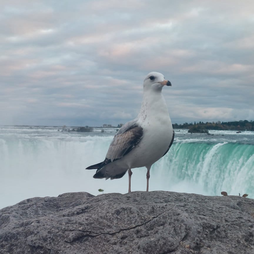
Niagara Falls
Niagara Falls is a group of three waterfalls straddling the border between Ontario, Canada, and New York, USA:
- Horseshoe Falls (Canada) – the largest and most iconic.
- American Falls (USA) – dramatic, with large boulders at its base.
- Bridal Veil Falls (USA) – smallest, separated by Luna Island.
Canadian Side (Ontario)
- Location: Niagara Falls, Ontario, Canada
- Main Visitor Address:
6650 Niagara Parkway, Niagara Falls, ON L2E 3E8, Canada - Managed by: Niagara Parks Commission
- Landmarks Nearby: Horseshoe Falls, Table Rock Centre, Journey Behind the Falls
American Side (New York)
- Location: Niagara Falls, New York, USA
- Main Visitor Address:
Goat Island – Niagara Falls State Park, 332 Prospect St., Niagara Falls, NY 14303 - Managed by: New York State Office of Parks
- Landmarks Nearby: American Falls, Bridal Veil Falls, Cave of the Winds, Maid of the Mist
History of Niagara Falls
Indigenous peoples, especially the Haudenosaunee (Iroquois Confederacy) and Neutral Nation, have lived around Niagara for thousands of years. Niagara means "thunder of waters" or "neck" in various Iroquoian dialects. The Falls were considered sacred and used as a boundary and ceremonial site.
It was first documented by Europeans in 1678 by French priest Father Louis Hennepin, who traveled with La Salle. It became a natural wonder known throughout Europe and North America by the 1700s.
By the 19th century, the area was harnessed for hydroelectric power, especially by inventors like Nikola Tesla and George Westinghouse. In 1895, the first major hydroelectric station was built on the American side. Niagara remains one of the largest sources of hydroelectric power in North America.
The Falls became a major tourist attraction in the 1800s, with railroads bringing visitors from across the continent. The Canadian side developed grand hotels and panoramic views; the American side emphasized natural conservation.
Niagara Falls State Park (USA) was established in 1885, making it the oldest state park in the U.S., thanks to landscape architect Frederick Law Olmsted.
Fun Facts
Niagra Falls played a strategic role in the War of 1812 between the U.S. and British Canada.
Famous tightrope walkers like Nik Wallenda and daredevils in barrels have made headlines attempting stunts over the falls.
Cedar Falls (Hocking Hills State Park)
Blackhand Sandstone formed the falls over 300 million years ago during the Allegheny Plateau uplift. Early 1800s settlers thought hemlocks were cedar trees, giving the falls its name.
A small grist mill was built around 1830 at the top. The remnants are still visible.
The region was used by Shawnee, Delaware, and Wyandot tribes.
It is located along State Route 374, near 21560 OH‑374, Logan, OH 43138 (approx. 39.4187° N, 82.5247° W)
Accessible via Gorge Overlook or Grandma Gatewood Trail; about 0.4–0.5 mi one-way (loop)
- Height: ~50-foot plunge over Blackhand Sandstone into a scenic pool below
- Volume: Highest water volume of any waterfall in Hocking Hills
Conclusion
We hope you enjoyed the video and information about the falls!